


Every Jeep has a story.
For someone out there it may be the result of a long-held promise to graduate college. For another, it might be Saturday nights delivering meals to the less fortunate. Maybe your story is something you’ve experienced with your Jeep club or a cross-country trip with friends.
All these stories bind us. Captivate us. They prove to us that these iconic vehicles are something more than just hunks of metal clogging our driveways or invading our garages. In the process, they generate memories that last forever.
At The Quadratec Channel, we are all about the story. And we realize these great products we send out everyday to Jeep owners around the world can help make every story better – one shipment at a time.
Welcome to Tuesday's Tale - a Quadratec Channel Exclusive. On select Tuesdays in 2017, we will share someone's personal and passionate Jeep story in their own words. So come along for the ride and read all about what makes these vehicles so great for other Jeep enthusiasts. Or, even better, tell us your story: [email protected].
-----
For this week, we look at the great American Jeep trip. It is something that many of us think about quite a bit - just take several weeks off and head out in the Jeep to visit all kinds of places. National parks, trails, towns, oceans; the possibilities are endless if you have the time. One of our former co-workers recently took such a trip. It wasn't his first grand Jeep adventure, but on this one he kept a record of his travels. So for this Tuesday's Tale, we present a man, his Jeep, a trailer and a trip that went 'Not As Planned'.
His story:
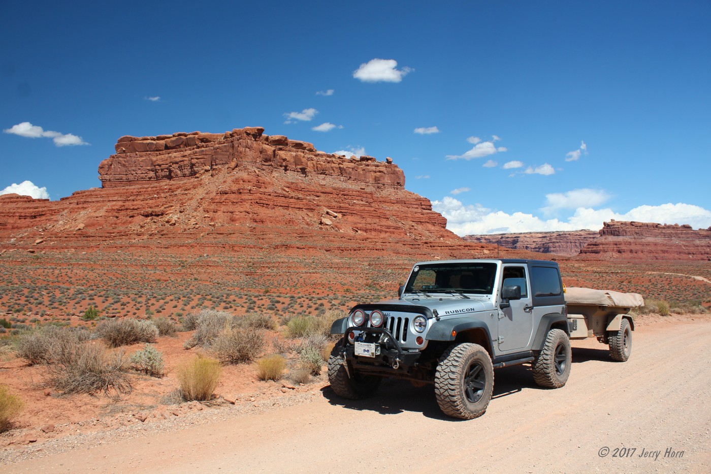
Jerry Horn - 2012 JK
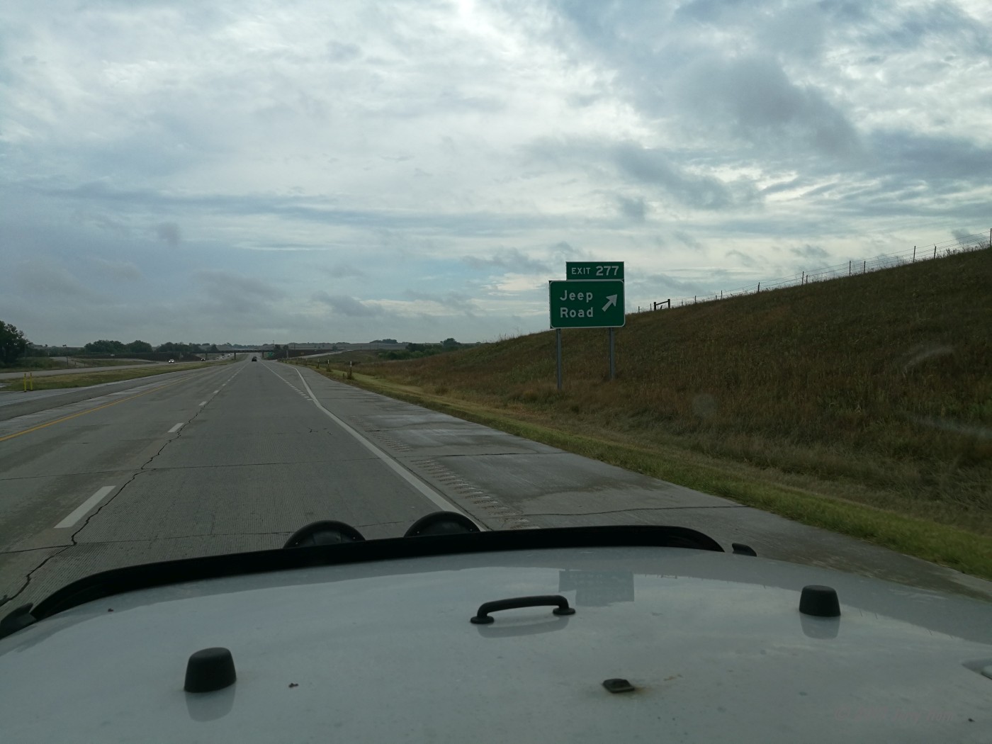
In the spring of 2017, I submitted a vacation request to use 120 hours of time off. See, I work as an EMT and work most holidays, so I’d accumulated several hundred hours of vacation time. I work nights as well, so I planned for a last shift on Sunday, August 27th, and then hit the road sometime on Monday night for what I hoped would be an incredible Jeep trip. Well, I had a lot of things to finish on my checklist and ended up leaving bright and early, in the rain, on Tuesday the 29th.
My Jeep trip out West began fairly uneventful, just drive, fuel up, drive some more, with a short rest stop in Ohio and another in South Dakota. Well, mostly uneventful anyway. I smashed a few thousand bugs on my windshield, using several gallons of washer fluid. I’ve always hated this… the single spray nozzle on the 2012 hood misses the lower driver’s side corner of the windshield, starting right at eye level!
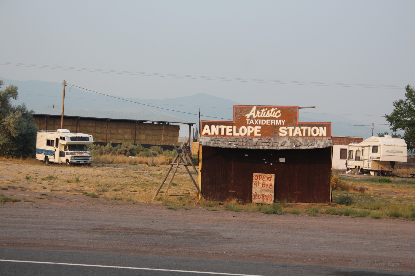
I talked to a friend at Quadratec and they shipped a bug deflector ahead to friends in Utah (thanks, Quadratec!). My destination was Clark, WY… a rather small speck on the map in northwestern Wyoming. I took a northern route, leaving I-90 to take US-212 from South Dakota, briefly in Wyoming, and then into Montana, crossing the Northern Cheyenne Indian Reservation. Dawn found me in the reservation… rough roads and smoke from the wildfires across the region. Shortly before 8am on Thursday, August 31st, I spotted a sign along the road for the entrance to the Little Bighorn Battlefield. Oh, cool! I didn’t realize this was along my route, so I stopped for fuel and waited for the gate to open. I spent an hour or so there, before continuing on to Clark.
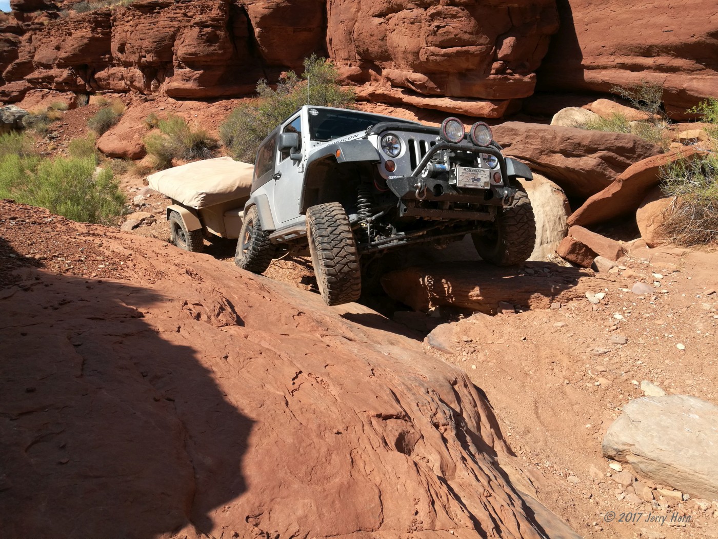
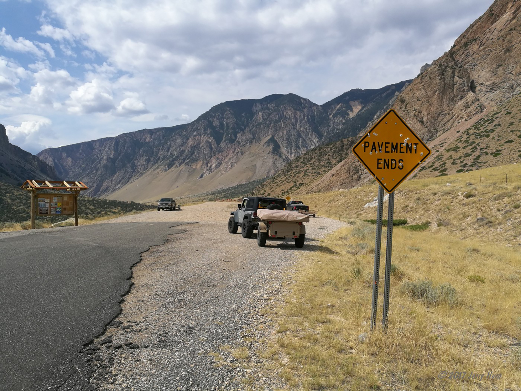
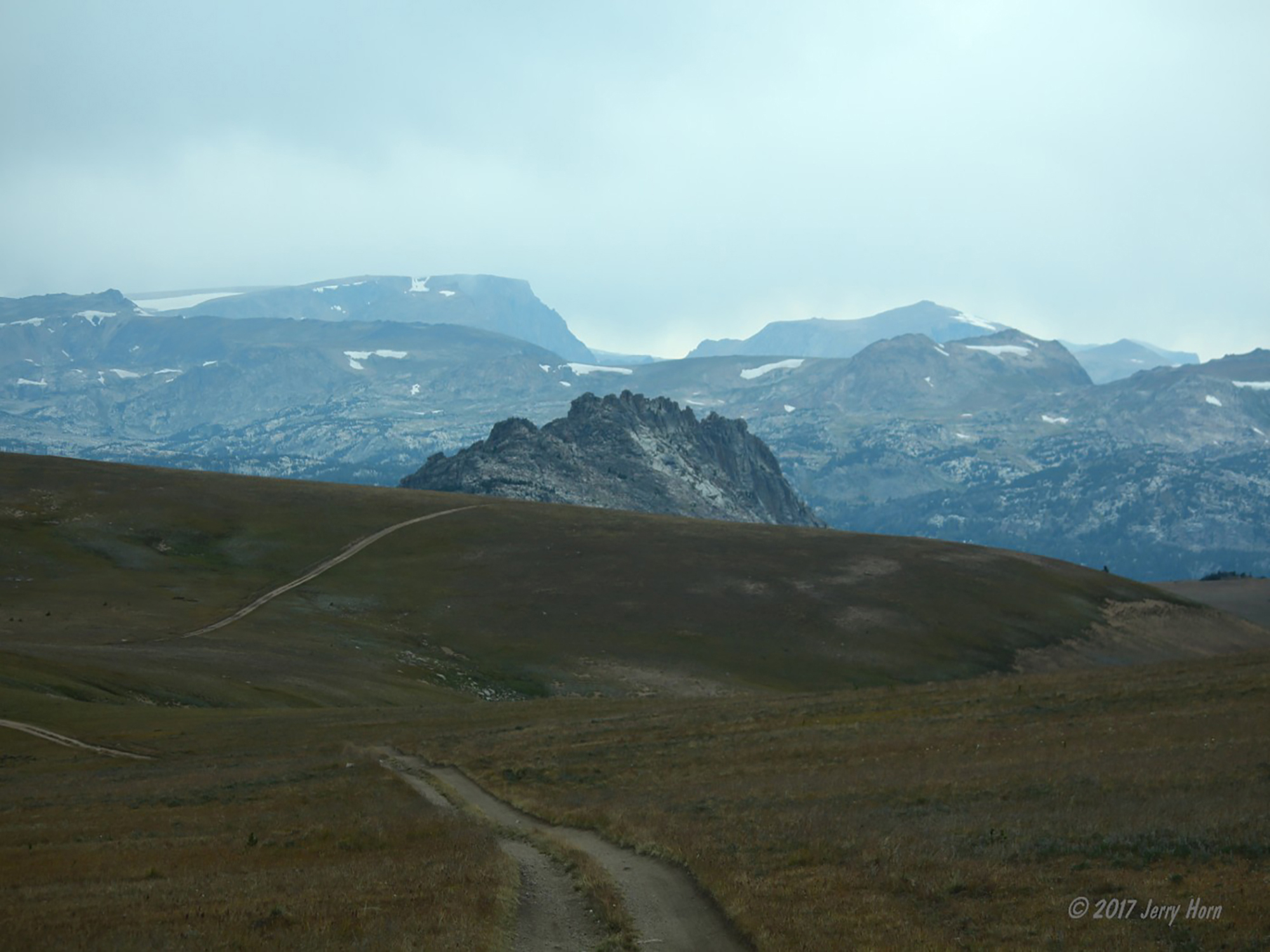
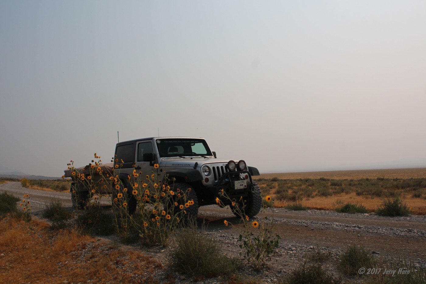
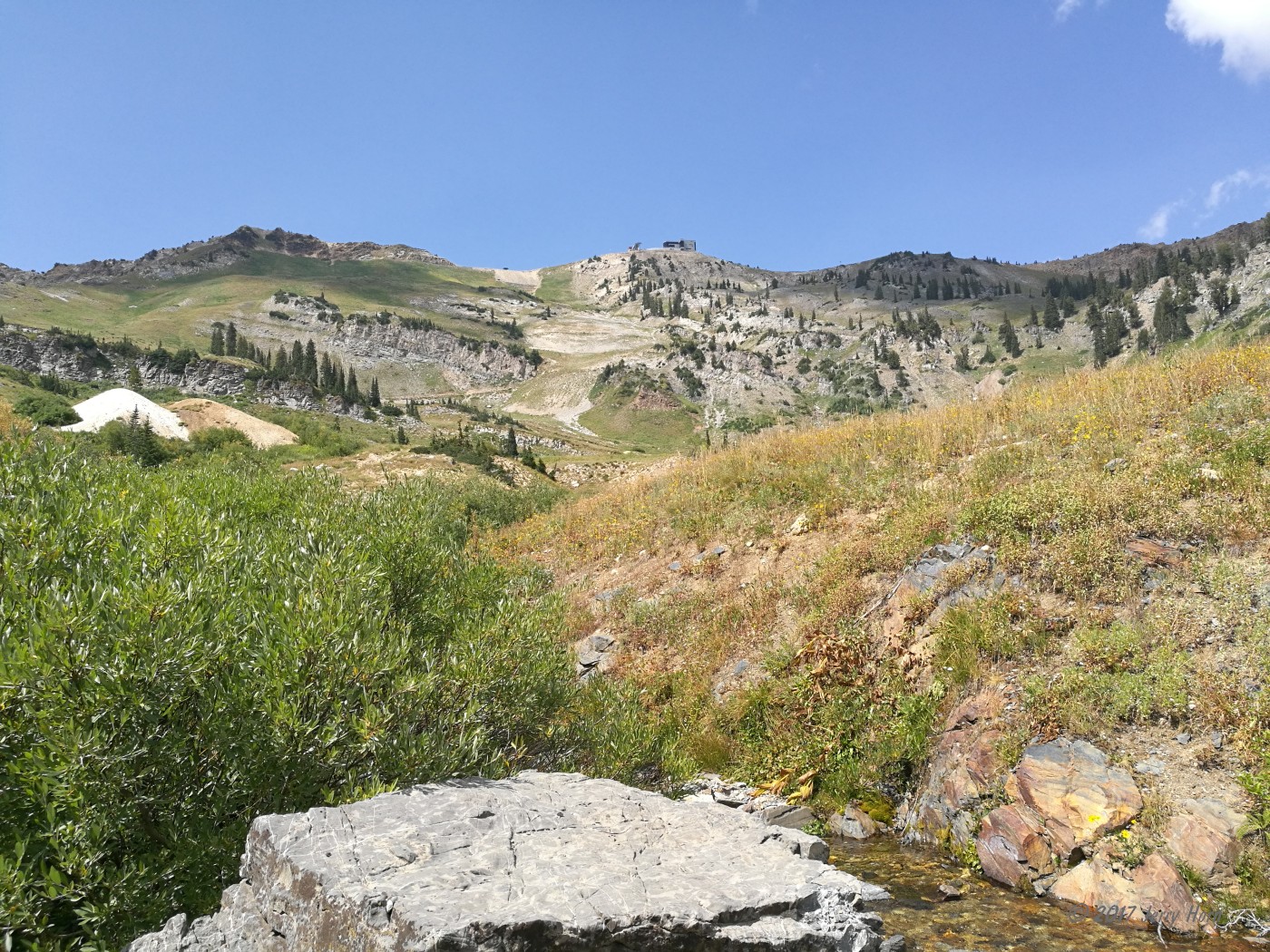
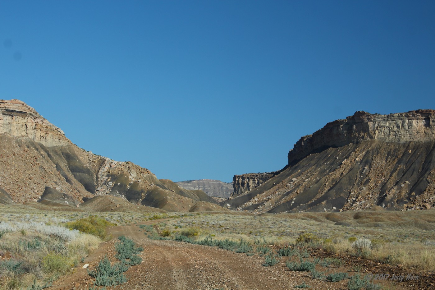
My target was the 22-mile long Morrison Jeep Trail. I’d come across this during an internet search for Wyoming Jeep trails several years ago, and later saw it featured in a video by Expedition Overland. The XO guys took a medium sized trailer behind an SUV with some difficulties. My Jeep and trailer are a much smaller combination, so I figured it would be a fun trip. I wasn’t disappointed. To reach the trailhead, the road starts by running along ranches until you enter an amazing valley. There, the pavement ends and the smiles begin.
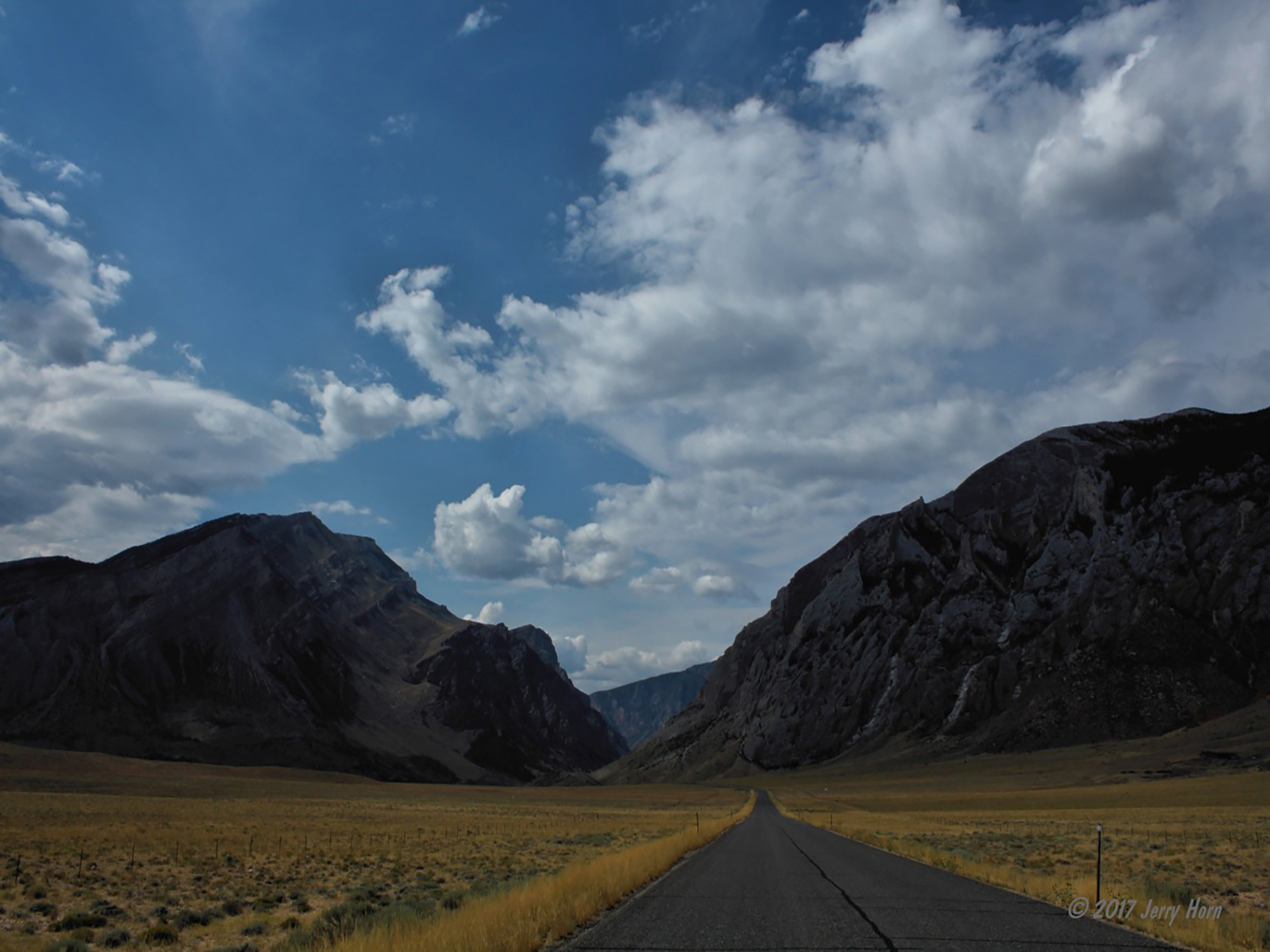
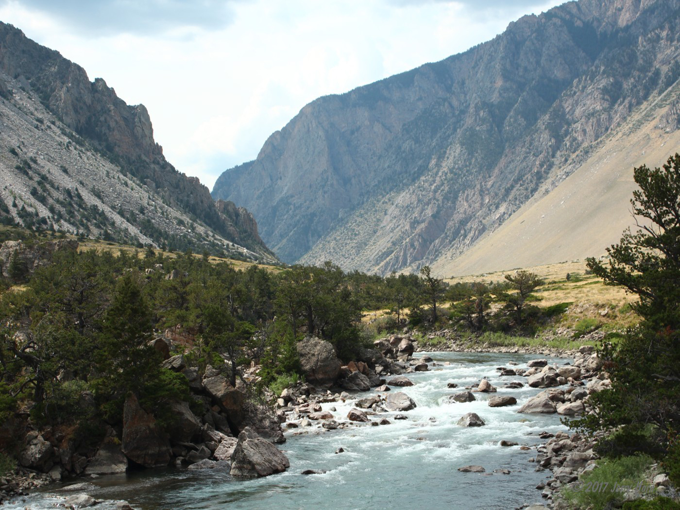
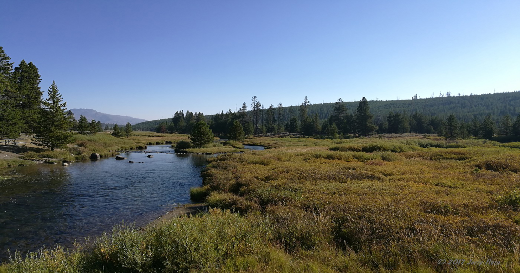
The trail starts off following the Clarks Fork River, which looked like a great place for fly fishing. After a few miles of rocky trail, the trail takes a hard turn right and a forbidding sign reads “WARNING Single lane road with no turnouts. Very steep grade and tight switchback turns next two miles. PLEASE USE CAUTION”.
After pausing for a photo, I start up the trail. There was a sign at the gate warning of construction work ahead, so I checked at every switchback for opposing traffic and workers before proceeding. Wow… talk about tight switchbacks. Most Jeepers and 4×4 folks talk about the infamous Black Bear Pass as being a dangerous switchback trail, but it has nothing on this one. Twenty-seven switchbacks climbing around 1500ft, many of which will require a 3-point turn, even for a 2-door Jeep -and the drop is no joke.
A stock roll cage will not protect you. Longer rigs might benefit from just reversing up a section or two instead of trying to make a 5-or-more-point turn. Lockers were needed for a few sections of loose/rocky trail, but make sure you turn them off for the switchbacks or they’ll ruin your turning radius. Near the last switchback, I did pass a very surprised guy in a mini-excavator. I stopped and checked to see if he needed water or anything and congratulated him on his skills on getting that machine up the trail.
There was a strange cattle guard at the top of the switchbacks, very tall… I actually snagged the trailer tongue jack on it and bent the foot. While the worst part of the trail was behind me, there are still a few narrow and steep sections ahead before it turns into more comfortable meadows and mountain/ forest trails. At one point, I start getting pelted with cold rain from higher snow showers, but it blows through pretty quickly.
The trail is mostly on national forest land and the trail passes through free range cattle and goat grazing areas. I made friends with some pretty curious cows before moving along. Around halfway through, I heard an odd noise so stopped to check and found that my right rear shock had broken the crosspin and was dragging on the ground. I grabbed tools and unbolted the lower mount and tossed the shock into the trailer and continued onward.
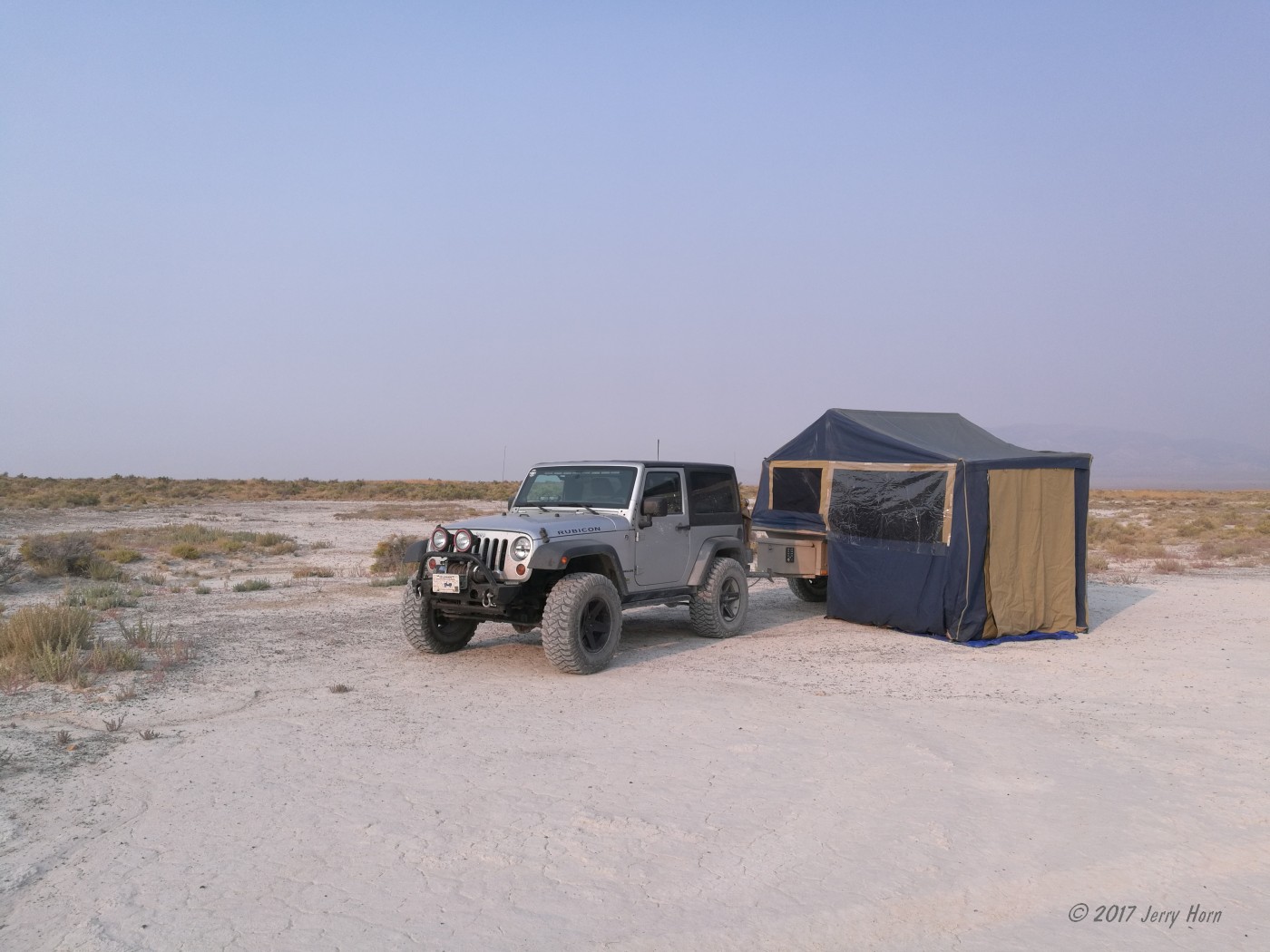
I had hoped to camp near one of the lakes up on the plateau, but pulling off the trail there would have left noticeable tracks on the alpine tundra - perhaps legal per the dispersed camping guidelines, but not ethical for a Tread Lightly advocate. I didn’t find an established campsite until the end of the trail, but there was a dead tree with a good risk of falling in a strong wind, so I continued on to pavement.
I had planned on entering Yellowstone the next morning after camping, but I ended up entering the north-east entrance at Cooke City, MT a little after sunset. Late evening is the worst time to enter the park, since the campgrounds are already filled… I had to drive several hours across the park to a campground, Indian Creek, with available spots, so I stayed there two nights.
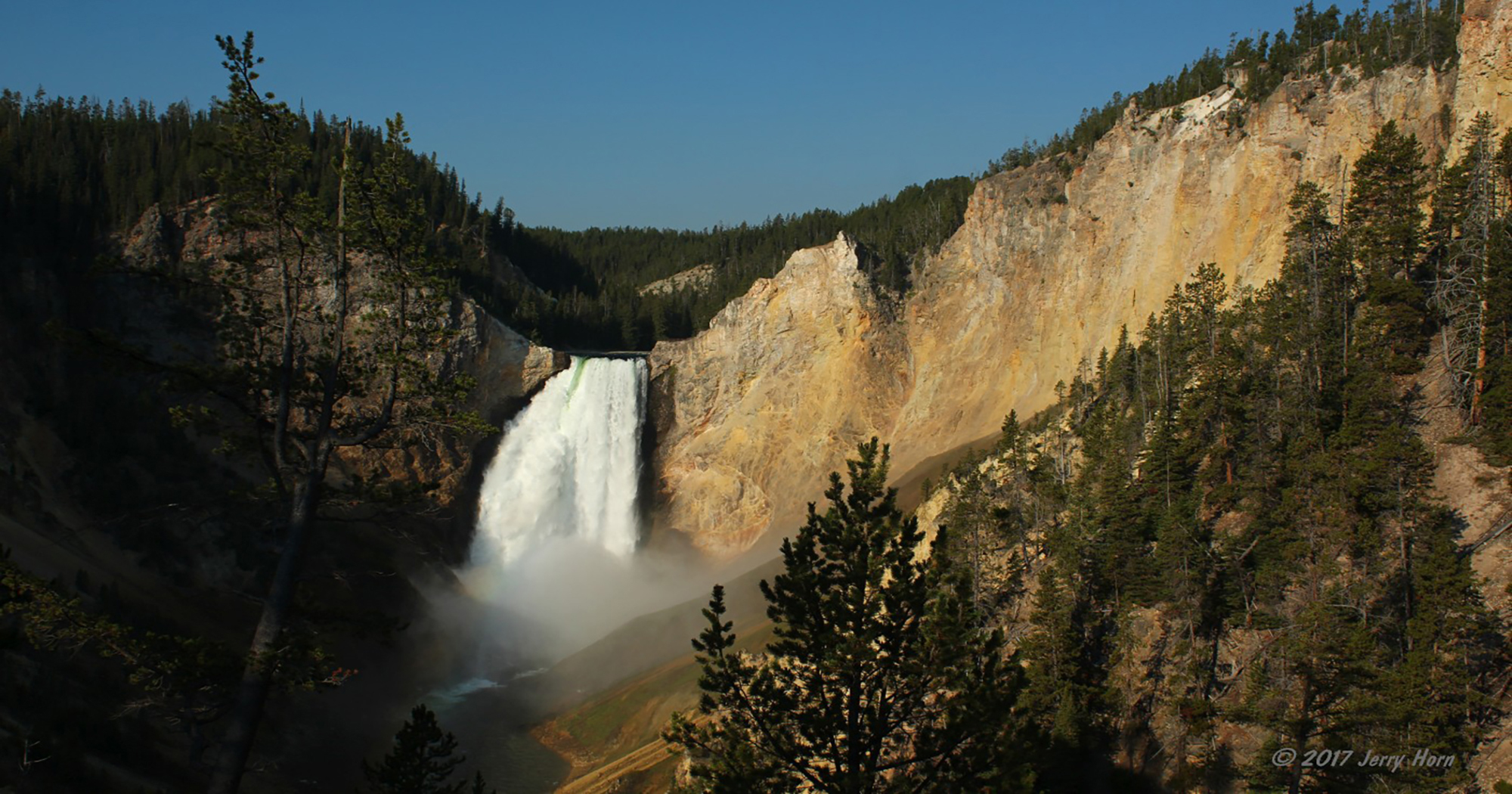
I awoke early on Friday, September 1st with plans of seeing the Lower Falls of the Yellowstone River. Success! There are multiple viewpoints and I tried three of them, with excellent results. I visited first thing in the morning, so there was an easily visible rainbow from the mist. The rest of the day I drove around the park, checking out some spots I hadn’t seen during my last visit, including the only public dirt road in the park. I got back to camp early and, after chatting with some fellow campers from Manitoba, hit the hay before sunset, allowing me catch up on sleep.
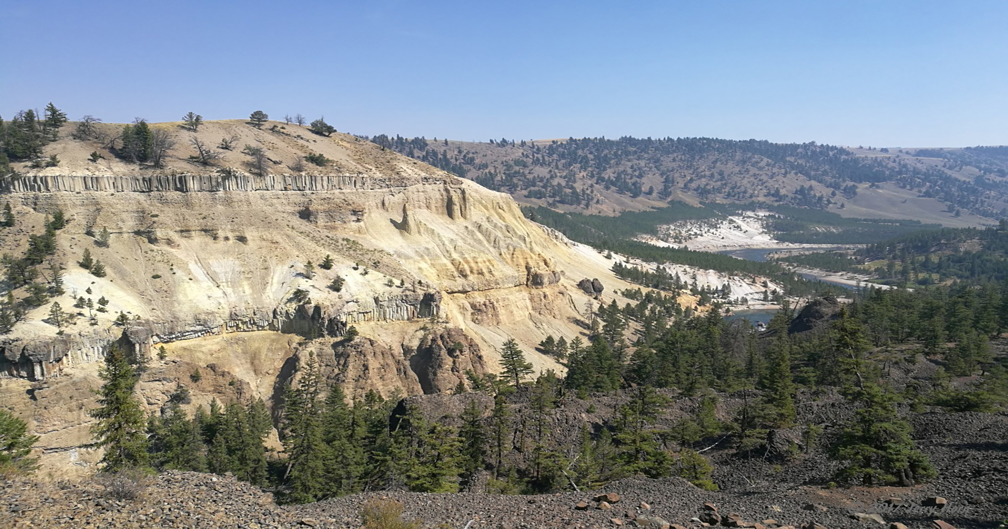
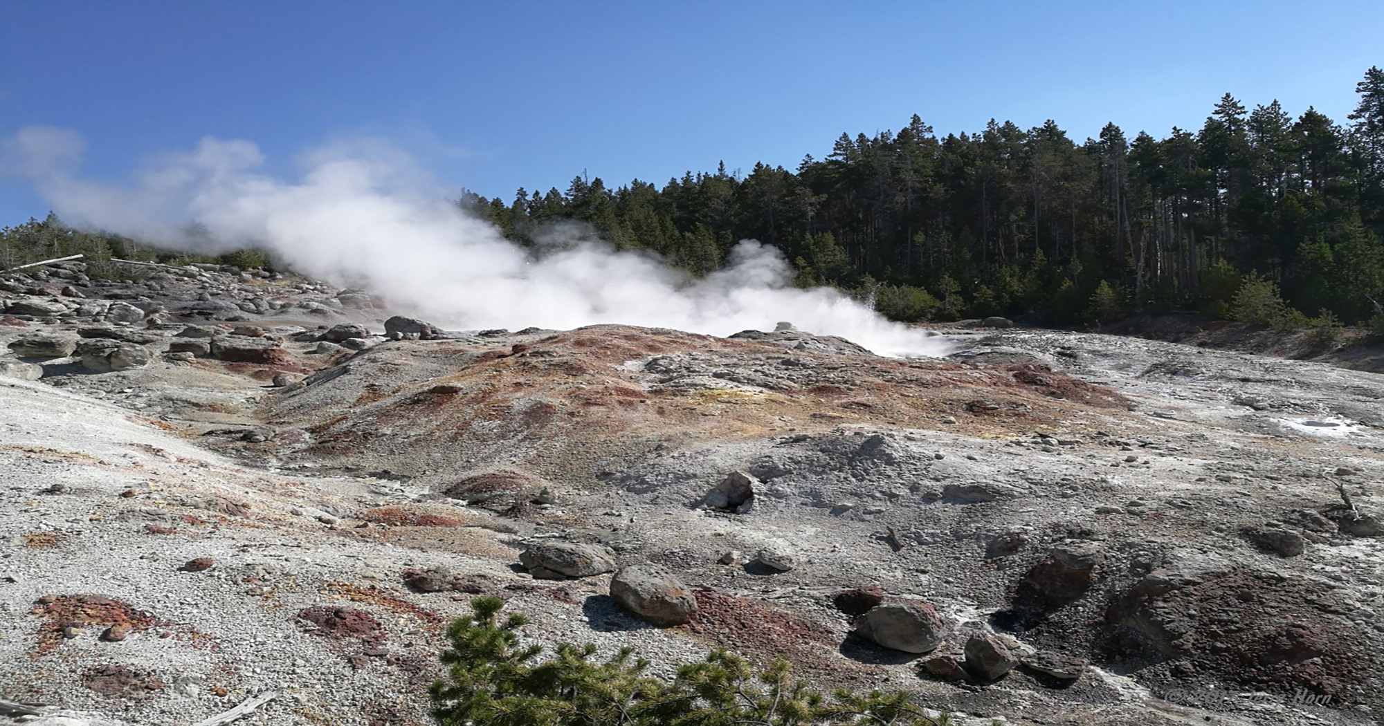
Saturday, September 2nd, I decided to head out, so I packed up and rolled toward the west entrance, stopping at a few points along the way including the Norris Geyser Basin and watched the Steamboat Geyser vent and throw short splashes. If it would have erupted, I likely wouldn’t have had a good day, since it can erupt more than 300 feet in the air.
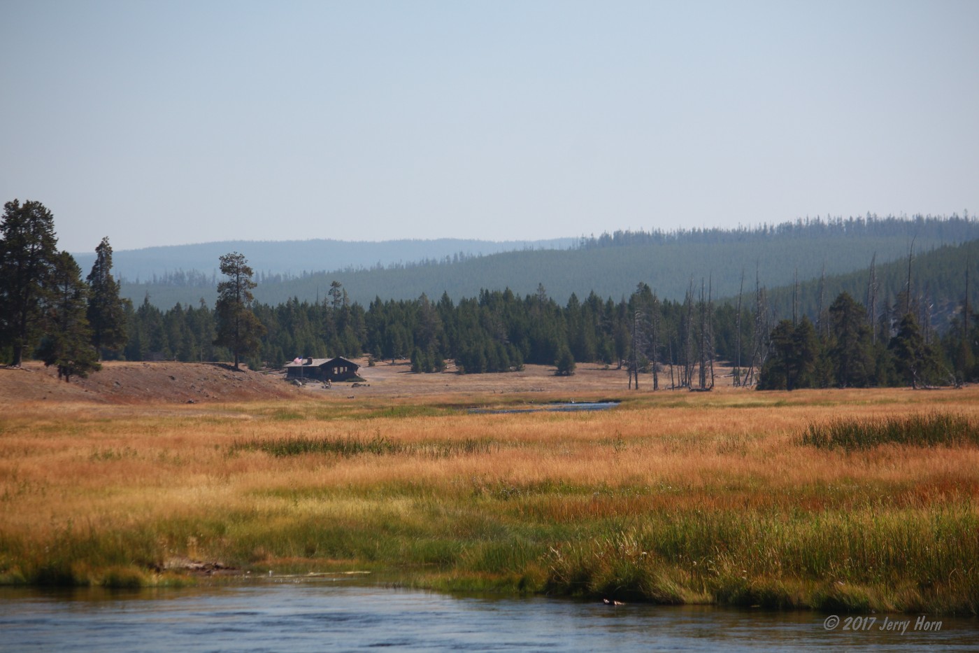
I also stopped at the Madison information office and enjoyed an amazing view of the valley from the windows… a little jealous of the park rangers who get to enjoy that view all day long. After that, I stopped along the Madison River for lunch and enjoyed a view of perfect fly fishing areas.
After exiting Yellowstone into Idaho, I started crossing the state… more of that drive, fuel, drive combination. I stopped briefly to put out a small brush fire along the road and kept going until the first “not as planned” moment entered the stage.
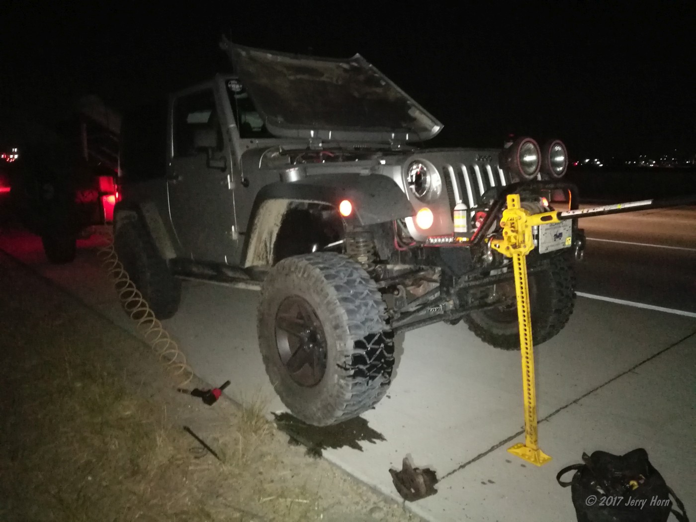
While passing through Boise, I heard an odd noise and felt a jolt in the steering wheel. I hit the brakes and the pedal went right to the floor. Yikes! So, I shifted into neutral, yanked the parking brake, hit the hazard lights and grabbed the trailer brake controller… slowing safely to a stop on the shoulder. I crawled under the Jeep and surveyed the damage; brake fluid all over the front passenger tire, a ripped brake hose and missing caliper. Wait, there’s the caliper on the wrong side of the wheel.
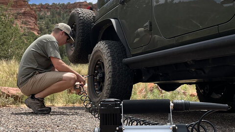
I grabbed tools from the trailer, fired up my air compressor and set up the Hi-Lift jack. An Idaho state trooper stopped by as I was grabbing the tools and decided to let me be, rather than call for a tow truck after hearing my plan. I lifted up the front of the Jeep and quickly pulled the tire (impact guns are awesome). I took off the caliper and put it in the trailer, and then grabbed vise grips as well as duct tape to take care of the ripped brake hose.
Several years ago, during one of my club’s trail rides at Anthracite Outdoor Adventure Area, a Jeep had ripped off a brake hose, so since then I carry vise grips and duct tape in addition to the brake fluid with my emergency fluids.
I limped off the highway to the safety of a parking lot and after a pity party (or two), I posted on Facebook asking for help and to start coming up with a plan. It’s now 10:30 at night on a Saturday, and a holiday weekend, so finding parts might be tough. After checking the online inventory of the parts places that will be open on Sunday, I did manage to find everything I needed except the brake hose.
When the shops opened in the morning, I start getting the parts… brake rotor, caliper, caliper bolts, brake pads. Luckily, I ended up getting help from two local guys who saw my Facebook post. One ran to a NAPA store (thanks, Rodney!) and pieced together a brake hose that’ll work for a few days. So, following the completion of that brake job in the NAPA parking lot in Nampa, ID (thanks guys!), I finally continue west. A 16-hour delay… but at least I’m not at work.
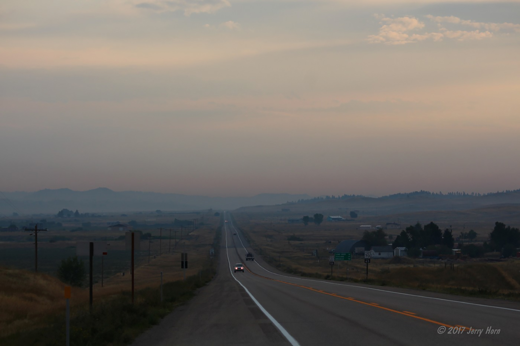
My crossing through Oregon was an experience. I took US-20 across the middle of the state, crossing endless desert as the sky became increasingly smoke-filled until I reached Bend, OR and started looping south toward my intended destination of Crater Lake National Park. The smoke was getting worse the further I traveled, so I diverted across the mountains and headed up to Eugene, a decently sized city with many parts stores and dealerships. Oh, and hotels with nice, hot showers.
On Labor Day, September 4, I checked the webcam for Crater Lake and confirmed my plan to skip the park and instead went north to Silver Falls State Park after parking my trailer behind the hotel. This State Park is home to 10 water falls along a nine-mile hiking trail, although since it was quite hot and humid, I cut the trail short and only visited three or four.
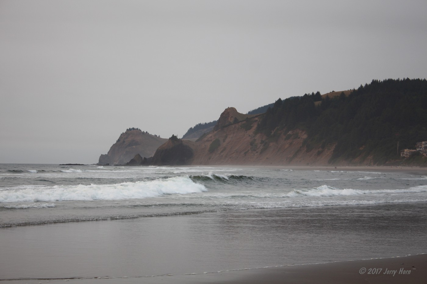
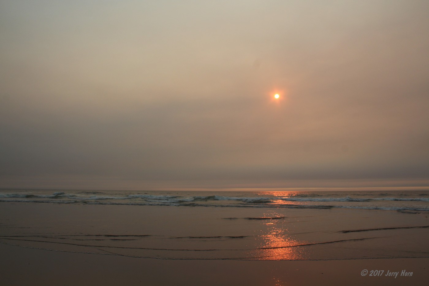
Leaving the park, I headed west towards the Pacific Ocean. At home, I am less than 2 hours from the Atlantic Ocean, but haven’t seen the Pacific, yet. After checking the map, I reached Roads End, a state-owned public beach. Surprisingly, it wasn’t crowded at all and there was plenty of available parking. Even over the ocean, there was smoke from the wildfires which made for an interesting sunset.
Tuesday morning, September 5, I started calling dealerships in Eugene looking for the brake hose I needed. However, no one around had one and the nearest was further up the state, in Portland. OK, I had hoped to cut through California and see the giant redwood trees on my way to Utah, and I really did not want to go north. So, I call dealerships in Salt Lake City. No luck there either and the nearest that way is in Colorado. After calling another NAPA in Salt Lake, and being told Portland was the only place around, it became clear I’m going to Portland.
While there, a guy at the NAPA suggests that I visit Timberline Lodge on my way to Utah. That works well, as the highway is closed because of the fires and the visit will work for a detour. I think I was about a mile away from the fires at one point, near Gresham… I know that ash was falling from the sky and folks were wearing masks to make breathing easier.
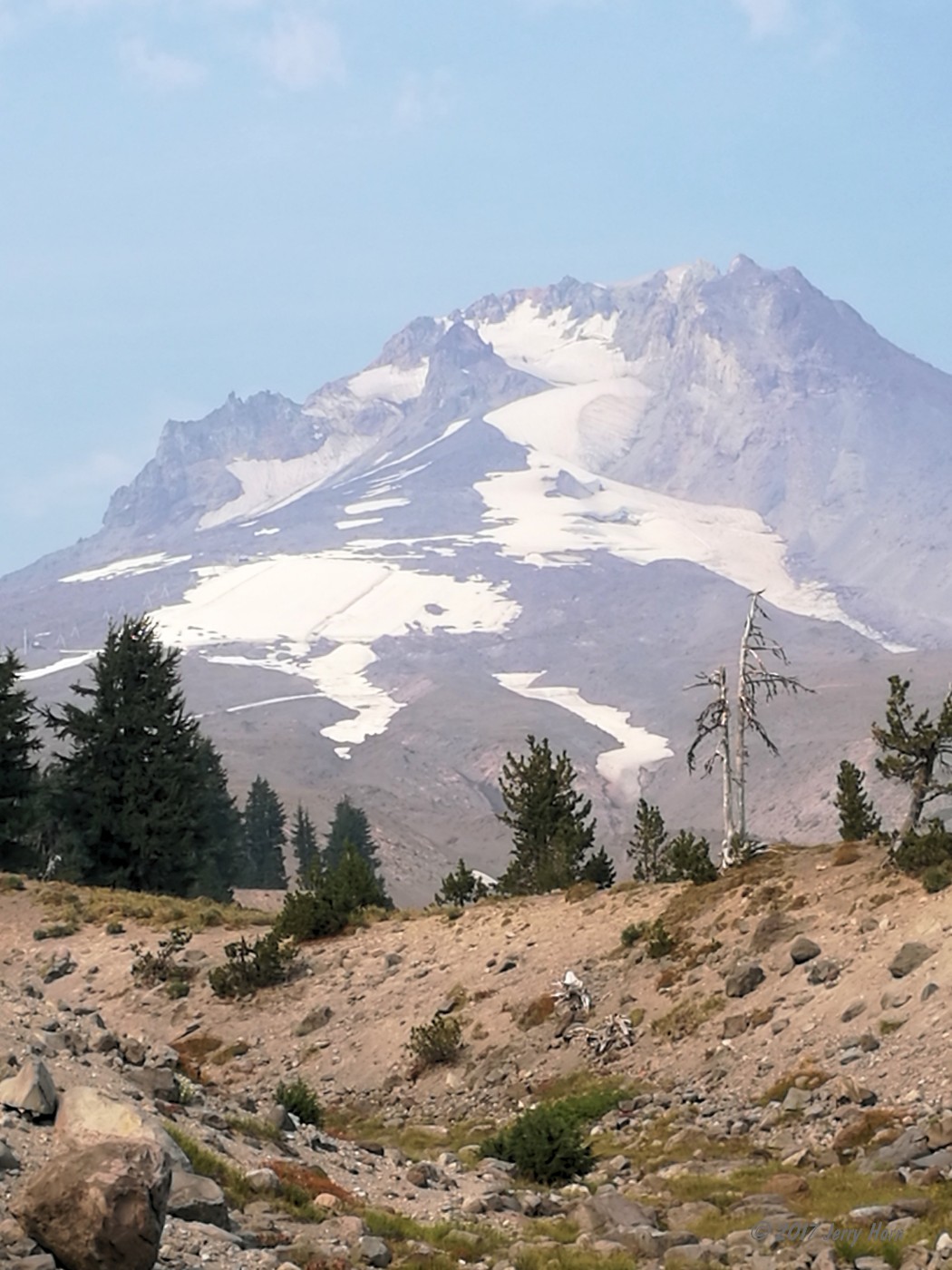
I pushed on toward the Timberline Lodge at Mount Hood and was amazed to find out they had just closed the ski runs two days prior! They were shutting down the ski lifts for maintenance and would re-open in a month for the start of the winter season.
After leaving Mount Hood, it was more drive, fuel, and drive while aimed toward Utah. On the way, I took notice that my gas mileage was pretty low over 2 tanks, so I checked the air filter. Surprise - clogged with ash and soot from the fires. Fortunately, I have an AEM intake with a dry filter, so I was able to blow it clean with my onboard air.
Following more drive, fuel, drive, a short nap and more drive, fuel, drive – I was able to install that brake hose and reached my next destination of Promontory, UT on Wednesday, September 6. Otherwise known as the Golden Spike National Historic Site.
I’ve been here before, but wanted to drive along the old Central Pacific route. Built in 1869 as part of the Transcontinental Railroad, it was used for 35 years until a better route across the Great Salt Lake was constructed. It still had limited use for the local ranchers until it was abandoned by the railroad during the Great Depression.
In the early 1940s, the rails were removed and used as scrap metal supplies for World War II, and the route is now a dirt road. A very long, very dusty, dirt road. It is also still directly on or near the original tracks for miles across the desert, with occasional signs explaining what was located there when it was active. After 60 miles or so, I set up camp and enjoyed a peaceful nights sleep in the desert. A bit breezy, but quiet.
On Thursday, September 7, I figured out I was getting low on fuel and time as I need to connect with friends east of Salt Lake City before dinner. So I divert off the trail and find pavement, after 106 miles of dirt road. You can drive great distances in the desert here, all on dirt roads.
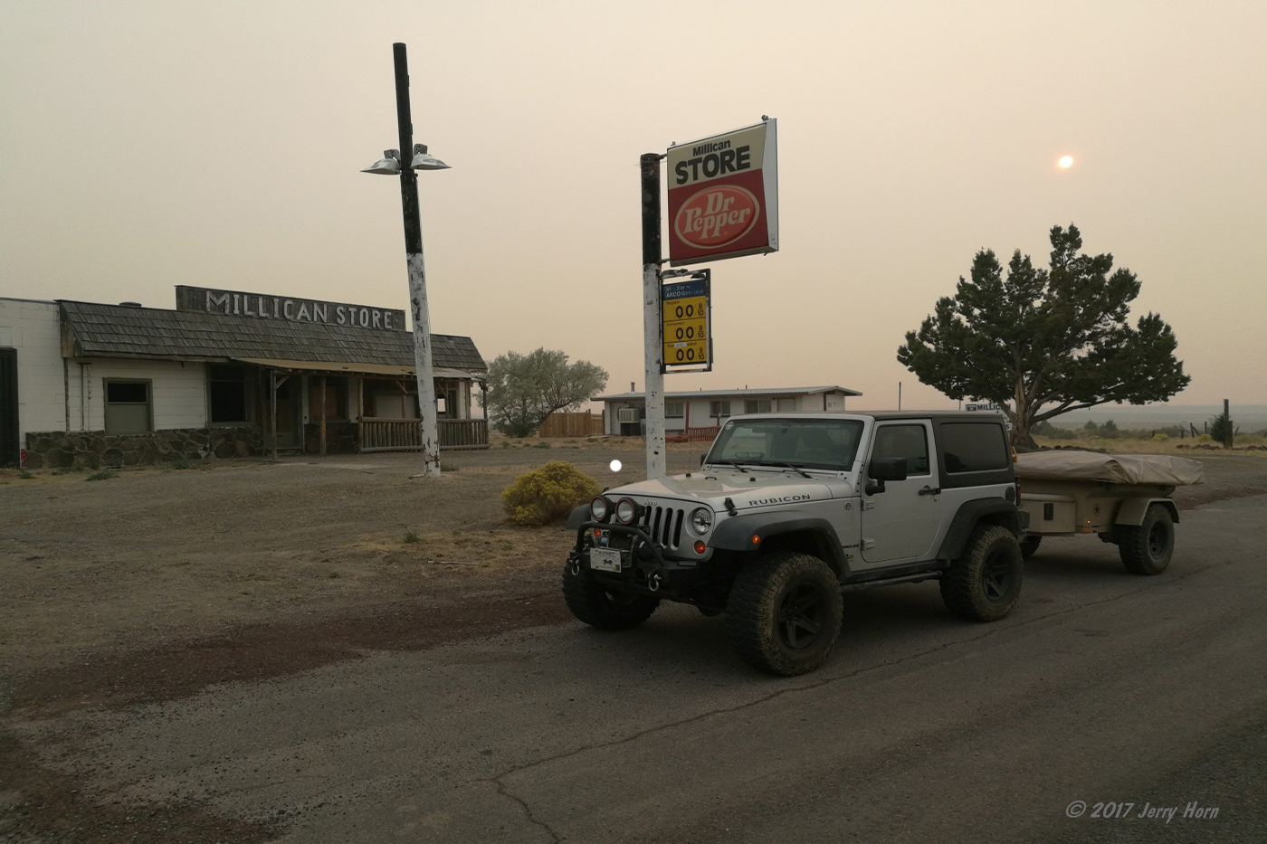
Before stopping for camp, I passed a guy who said he had been on dirt roads all the way from Elko, NV - well over 100 miles away. The fastest way there is actually to head around 30 miles further west into Nevada and pick up the highway. After refreshing my fuel with one of my gerry cans, I stop in the small town of Montello, NV and get a burger at the Cowboy Bar & Café - a decent (the only) local bar with a decent burger. Then it was more drive, fuel, drive until I reach my friends’ home when I enjoyed dinner with them and a good night’s sleep in their guest room.
Friday morning, September 8th, I headed out with one of my friends to try Mineral Basin - a 4×4 trail I found on the map. I decided to try a shortcut over the mountain, which ended up being a very tight, off-camber trail. Not challenging for my Rubicon, just very tight. A good warmup, though.
The Mineral Basin trail is a fairly technical and rocky trek with some good boulders and some fun optional hill climbs. Large tires and a lift are highly recommended if you plan to attack this trail, plus lockers are imparative if you’re going solo.
The trail dead-ends at the back of the Snowbird ski resort. You can hike through if you want, but there are signs clearly indicating that no vehicles are permitted past the boundary. So we turned around and headed back. Shortly after turning back, I encountered another ‘Not as Planned moment’ along a tight section of trail. My right rear tire slipped off a rock and not 30 feet later, I hear a hissing sound. Sigh… after the trail widens a little, I check the tire. A nice 2-inch slice on the sidewall.
I don’t really feel like changing out the tire at that point, so I use two tire plugs and re-inflate. But the plugs soon either popped out or were ripped out during another hard section of the trail. No matter; they were pretty old, so I wasn’t too surprised. I opened up a newer plug kit, re-plug and re-inflate the tire again. This time, it lasts the rest of the trail and back to my friends’ home. I treat them to dinner at a local cafe before another restful night in their guest room.
In the morning, I start looking for a new tire. However, the local tire shop doesn’t have anything in a 315/70/17 size - certainly not the Mickey Thompson MTZ tires currently on my Rubicon. But they have something close enough to use as a spare on their take-off rack for only $50. Deal!
I stopped at a car wash to spray off some of the dust and mud, then installed the Rugged Ridge bug deflector Quadratec had sent. Looks pretty cool, so let’s hope it works! I stop in to say farewell to my friends and hit the road. At the suggestion of my friend, I’m aimed toward the Dinosaur National Monument along the Utah/Colorado border.
I get there in the evening, and with enough time to visit the dinosaur exhibit on the Utah side before heading to the Colorado side to camp. I stay the night in the Echo Park campground along a “high clearance” dirt road. It’s bordered by the canyon walls, so any loud sounds echo off the walls. I put the quotes around “high clearance” because I did see a newer VW Beetle there. The rest of the road is definitely high clearance, though. They maintain this section due to its higher use.
On Sunday, September 10, I roll out from the campsite, heading further down the dirt road as it turns more into more of a trail than road. It passes several old ranches and homesteads before reaching pavement again. All in all, about 58 miles of dirt and a lot of great views, but now I am aimed for Moab.
Driving to Moab requires passing through some desolate areas, but areas with great views. I have a campsite reserved for two nights southwest of Moab in the Maze District of the Canyonlands National Park, so I find a campsite near there in order to enter the park first thing in the morning. I end up camping by the trailhead for Horseshoe Canyon, which is a 44-mile drive on dirt roads from Green River, UT.

On Monday, September 11, I have to head back to pavement to get fuel as that 44 mile drive yesterday burned a lot of gas. While heading toward Hanksville for fuel, I’m flagged down by a woman in a car on the dirt road. The car was scraping bottom on the dirt road and she’s worried if she can make it to Horseshoe Canyon for hiking. She wants to visit the Great Gallery, a site where ancient Native American rock paintings were found. I tell her about some rough spots I passed and she decides to turn around.
I follow her through the high spot and chat again after she stops past it. She’ll go rock hunting here so I let her know that I’ll check on her when I get back from the gas station. Two hours later, I stop back and we chat for a while. I offer to escort her to the trailhead and she asks if I’ll hike with her. I think about it, and say ‘Why not!’. The day is not going as planned, but hey… might be fun.
We get to the parking area a little before noon and start into the canyon. It’s hot out today, 90+ degrees in the canyon and a 780ft descent/climb into/out of the canyon. The entire hike is only a 7 mile round-trip, but it takes at least five hours due to the soft sand in the canyon and the steep climb. We stopped for a while to take in the paintings and our overall trip was six hours. A “not as planned” adventure, but certainly an adventure worth remembering! Nice to meet you, Kristina.
Back at my Jeep, it was way too late to get to my campsite tonight in the Maze District, plus I had a phone call I needed to make tomorrow, so I decided to head back to civilization. But first, I’m dead tired and hungry. I need food! I refuel in Hanksville and get a recommendation on where to eat. I visit Duke’s Slickrock Grille - a John Wayne-themed restaurant with a pretty good menu selection. And, most items on the menu are named with John Wayne film titles. I ordered ‘The War Wagon’, a yummy pulled-pork sandwich with steak fries. After recovering some energy, I headed toward Moab to camp.
After camping for the night on Bureau of Land Management land north of Moab, I woke up Tuesday, the 12th, and headed into Moab to restock my food and water supplies. Then I headed out for the Lockhart Basin Trail, a run I’ve wanted to do for the past few years. To get there, you first have to follow the trail for Hurrah Pass and Chicken Corners before turning off for Lockhart Basin.
The first two trails are easy, but Lockhart Basin is pretty hard for the first few miles and fairly rough the rest of the way. I got hung up with the trailer once (non-powered tires wouldn’t climb the ledge) and got the Jeep stuck a little while later. After trying unsuccessfully to stack rocks and reposition the Jeep, I was getting nowhere. No problem, I think… I have a winch and there are plenty of boulders to pull on.
I plug in the remote and hit the power-out switch. Nothing. Wiggle the clutch handle and the plug, and then try again. Nothing. Ugh. So I break out the Hi-Lift jack to stack more rocks. Some precarious jack operations later and… still stuck. I revisit the winch, but still nothing. I have a thought and check the battery. Doh! The winch power cable isn’t on the battery and I now remember replacing the battery several months ago and left the power cable off. Grabbed a socket and hooked it up. Five minutes later and the Jeep is free and continuing along the trail. An hour and a half delay and a lesson learned.

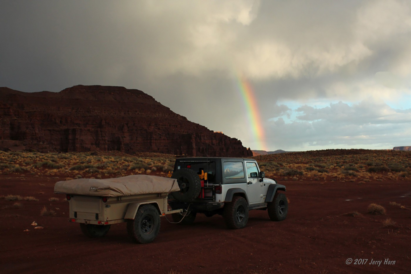
I keep moving along the trail, enjoying the views and stopping for occasional photos when I start to see rain clouds in the distance and get hit with a few light drops. I’m a little concerned here, as rain is the last thing you want in the canyons, especially when you’re on a difficult slickrock trail. Part of that risk is a flash flood with water coming off the plateau, and part is for traction loss on the wet sandstone. I’d checked the radar and forecast before I left town, but it was clear at that point.
As darkness began to set in, those occasional drops turned into a light rain which, thankfully, did not last long and wasn’t strong enough to give me any problems besides throwing a little mud. It was dark long before I finished the trail and I’d read the map book wrong for the time estimate; thinking the six hour estimate included Hurrah Pass and Chicken Corners trail - those added two hours.
Even if I hadn’t gotten stuck earlier, I’d still be finishing the trail in the dark. Because of the rain and storm risk, I decided to finish it out and not camp along the trail although I passed several great spots that I marked on my GPS should I hit any washouts further along the trail. Fortunately, I had plenty of light with my Quadratec LED headlights and Rugged Ridge HID offroad lights. Plus, several bright flashlights and a headlamp.
After 54 miles of trail, I aired up and returned to pavement before heading down to Blanding, UT where I camped near a reservoir for a few hours. The next morning, Wednesday the 13th, I stopped in Blanding to wash off some mud and moved on toward the Grand Canyon. Now, with clean mirrors I noticed that my trailer isn’t centered behind the Jeep. I also see that the trailer’s left tire is angled out noticeably, but I can’t see anything bent. I don’t see anything easily fixable, so I decided to air up the trailer tires more so they won’t give too much extra drag. I know it’ll scrub the tread down a bit, but I’ll deal with it. Moving on, I see a sign for the Bluff Fort museum in Bluff, UT.
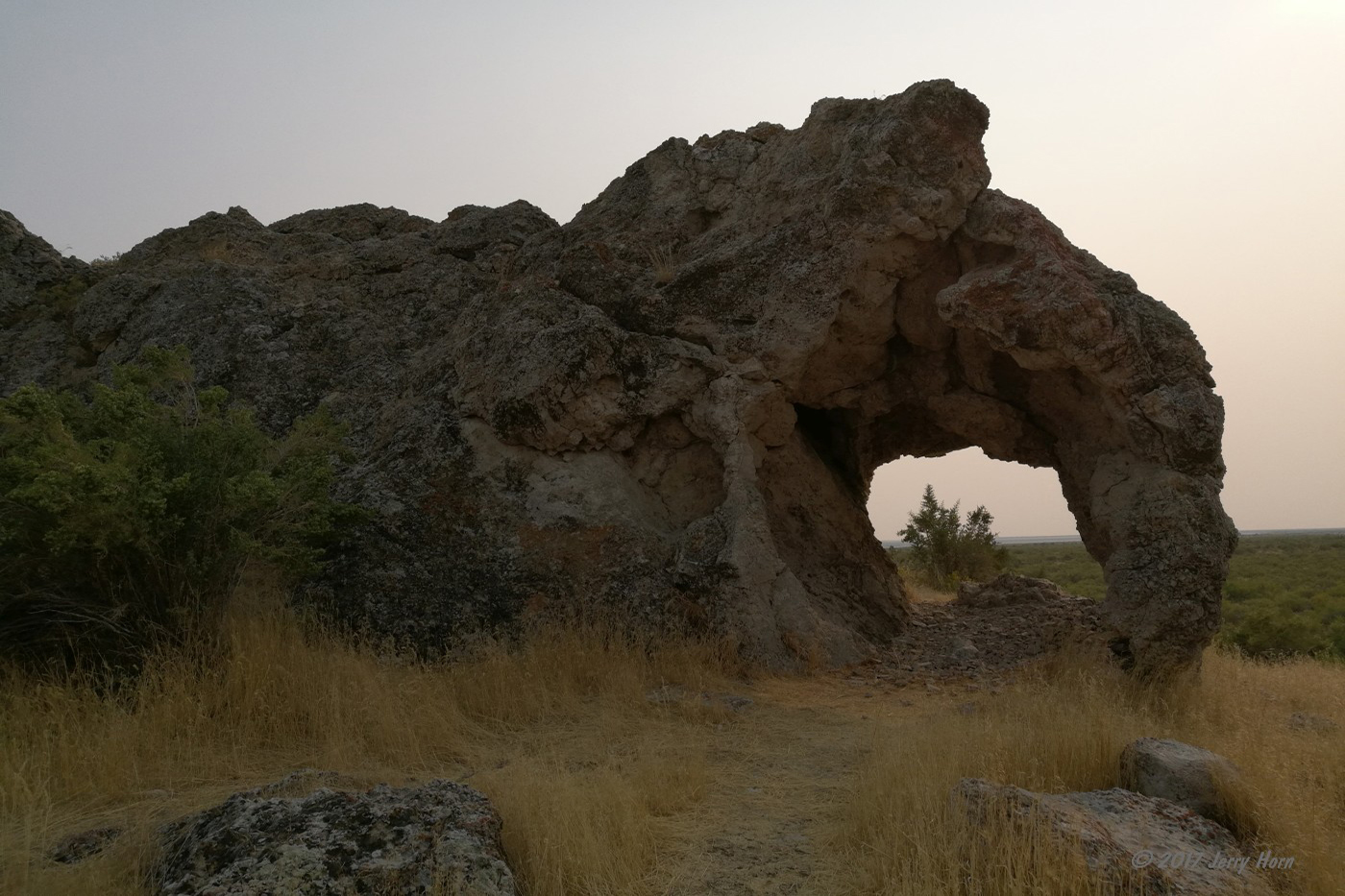
The Bluff Fort Historic Site and Visitor Center is an awesome free museum about the Mormon settlers that traveled to the area in 1879-1880 via the “Hole in the Rock Trail”. That alone was an amazing feat, cutting a path down a 1200ft cliff so they could cross the Colorado River with their wagon train. After many months of their own ‘not as planned’ construction exercise, they crossed the river and eventually reached this location where they built a fort while they settled the area.
While much of the original fort is long gone, there are a few original buildings still standing and others that have been rebuilt and decorated by the descendants of the original settlers. The volunteer staff is also mostly descendants of the settlers as well. There’s a lot to see, and you can look inside almost everything, including the craft center, where they make clothing and blankets to sell in the gift shop. They also have slip-on clothing in period styles so you can pose for photos.
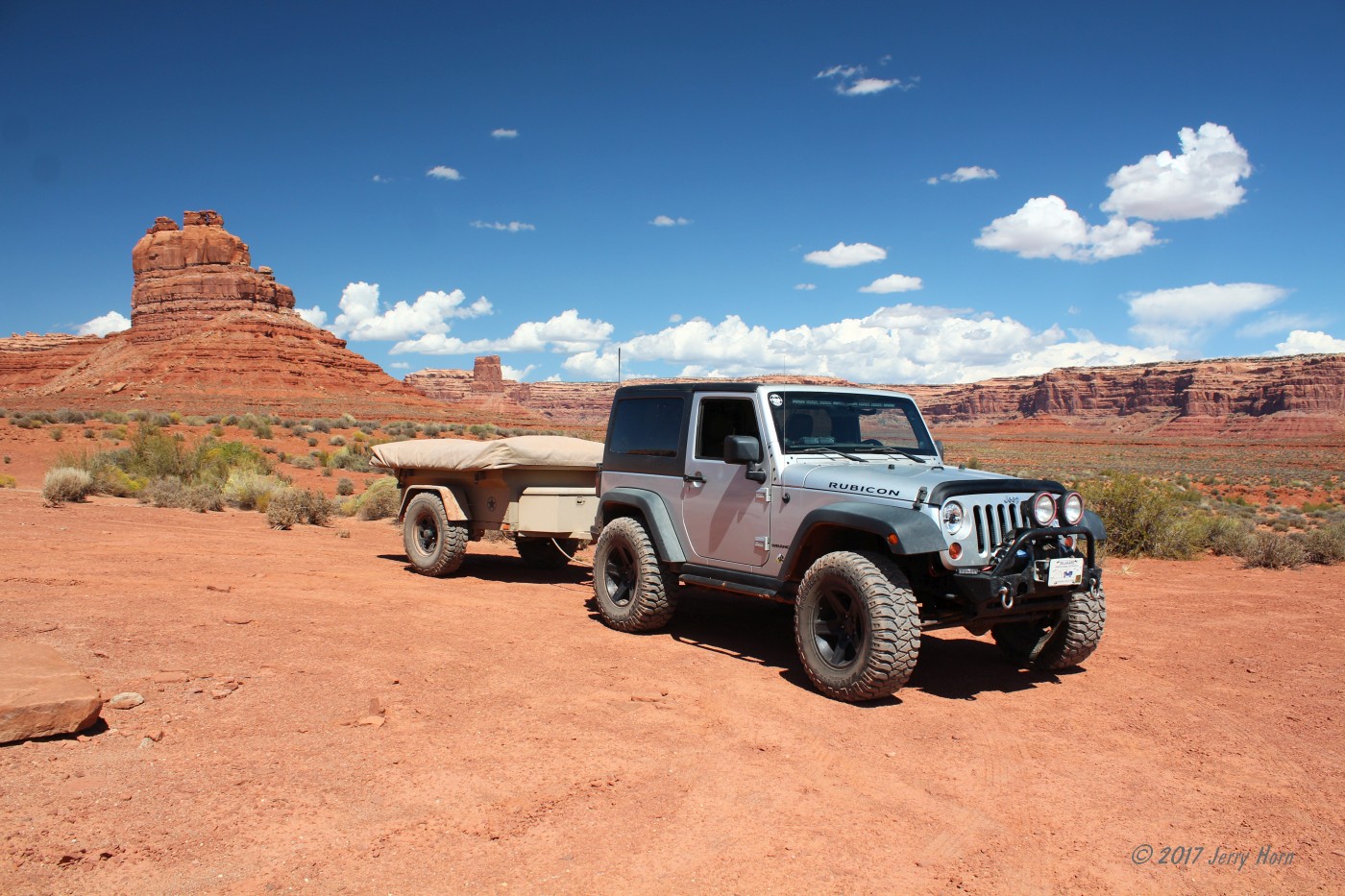
Following my stop in Bluff, I make a detour into Valley of the Gods, a 17 mile dirt road through BLM land that’s like a mini Monument Valley. It is a great detour if you’re in the area and driving an SUV or Jeep (high clearance required for a couple wash crossings).
I’ve been here before, but drove the clockwise route so this time I drove it in reverse. Not like I really needed an excuse because the views are always worth the visit. Plus, there is a bed and breakfast at the western end that I might visit in the future. The staff at Bluff Fort also recommended that I check out Goosenecks State Park, which is on the way back to the main road from the valley. So, I did. Not really much to do, it’s really just a parking lot with a great overlook of the river making multiple horseshoe turns in the canyon. I’ll definitely need a wider camera lens the next time I come back.
Returning to the main road, my destination now is the Grand Canyon. I have a campsite reserved tomorrow and hope to camp somewhere in the forest tonight. The route there passes Mexican Hat and Monument Valley, and continues through the Navajo Reservation driving through red deserts and canyons until reaching the forest.
I stopped in Page, AZ for fuel and noticed smoke was now coming off of the right trailer tire. Uh-oh. So I cut a slit in a water bottle and started spraying the wheel. The wheel, hub and brake drum are all sizzling hot, which turning the water to steam almost immediately. I kicked the tire and there’s a lot of play, turns out I roasted the bearings - an unexpected side effect of that misaligned axle.
I have AT&T cell service, so I don’t have a data connection and can’t look up parts or repair shops. After driving around for a bit, I manage to find a NAPA store, but they don’t know anything about trailer axles and refer me to a welding shop around the corner. They’re locking up as I walk up, but say that they have plenty of parts in stock and can work on it tomorrow. The hotels in town are all booked, so I have to spend the night in the Jeep since I obviously can’t go out into the desert at this point with the trailer to camp.
Sixteen hours later, on Thursday September 14, I talk to the guys at AZ Welding and drop off the trailer. They kindly refer me to a local restaurant for a great breakfast and I return in an hour to survey the damage - bearings all totally destroyed, and new brakes needed. Fortunately, they’re well stocked and have everything. A little sanding was required for the spindle, but it was serviceable. Darrell did an awesome job on the trailer, thanks!
After fixing that problem, we looked at the drivers side. When that tire had been caught behind the ledge on the Lockhart Basin trail, the 4:1 low gear in my Rubicon created enough torque to pull the axle plate out of alignment. We unbolted the mounting plates and had enough play to get it back into alignment, then tightened the bolts. Easy fix! I had been afraid that I’d bent something.
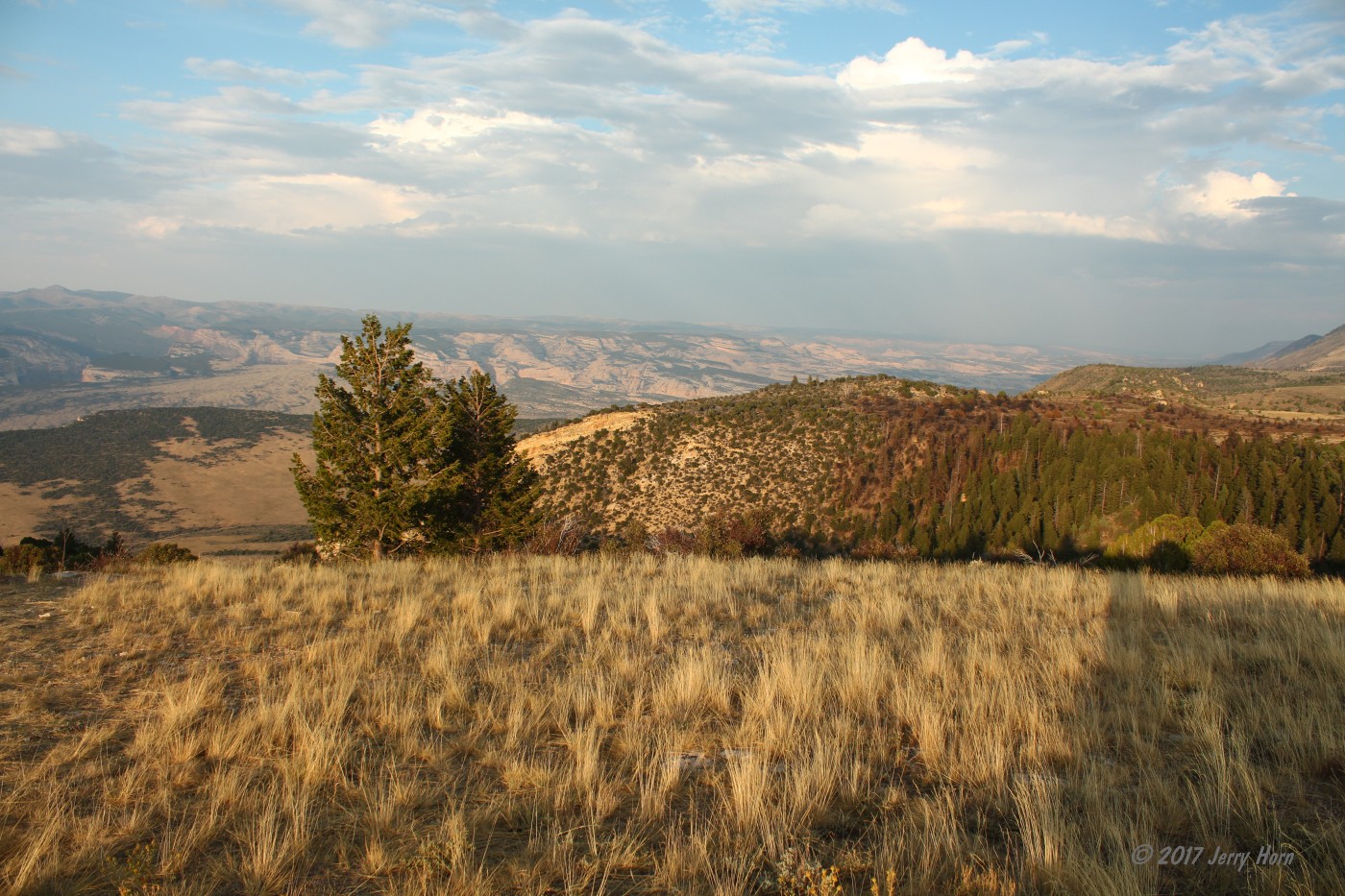
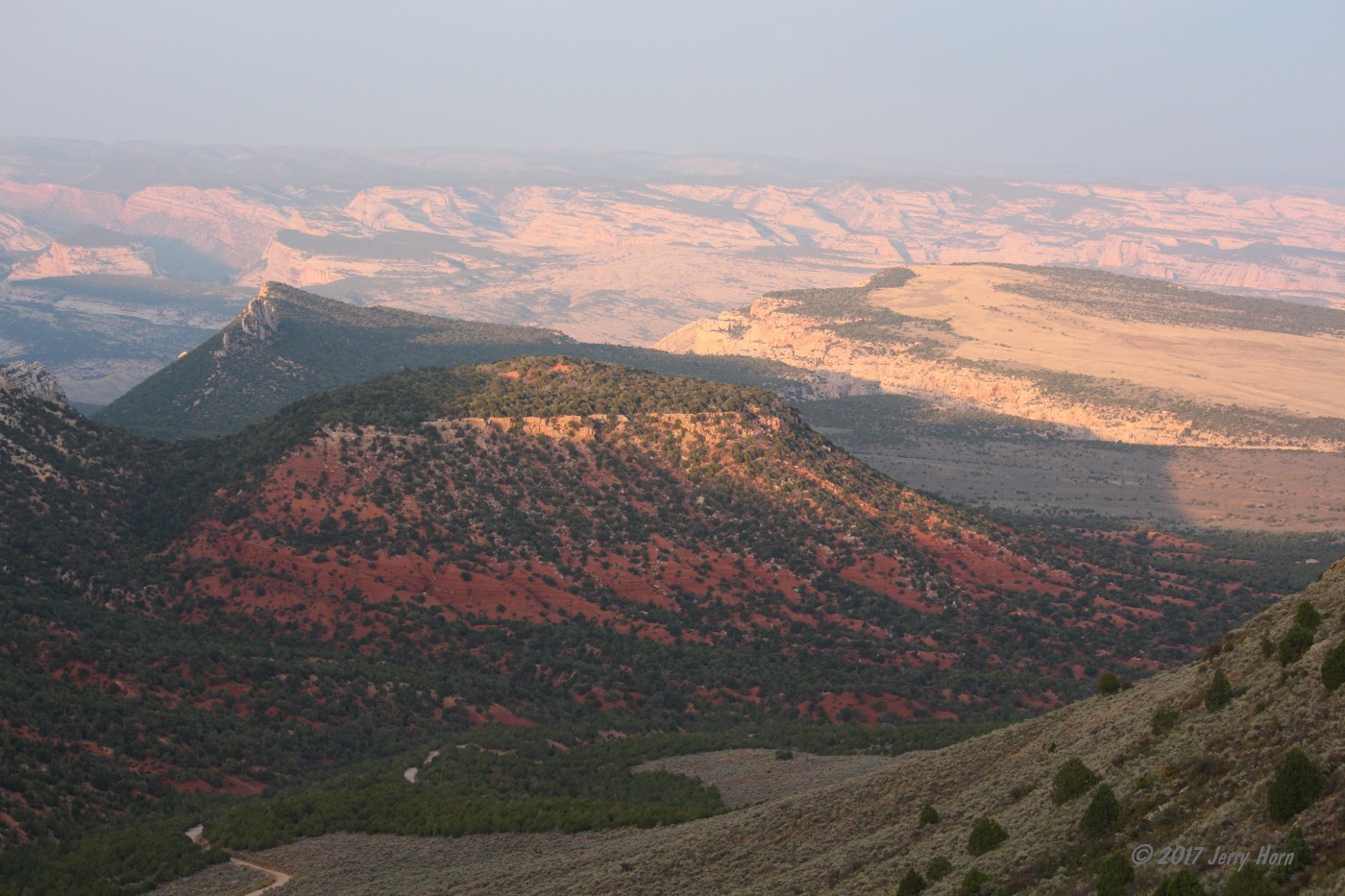
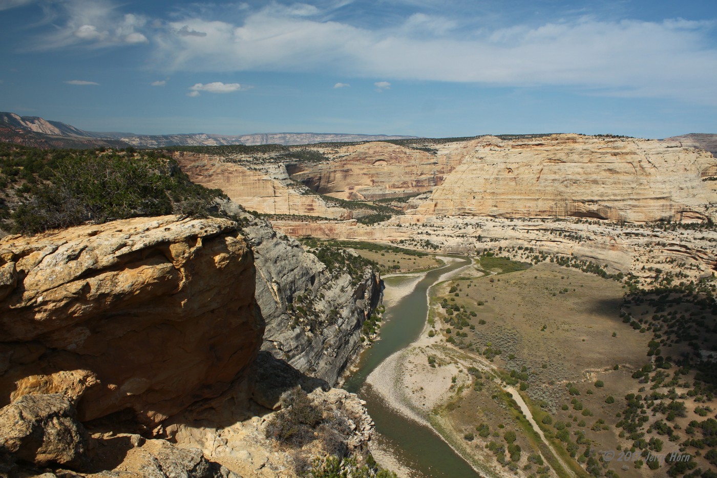
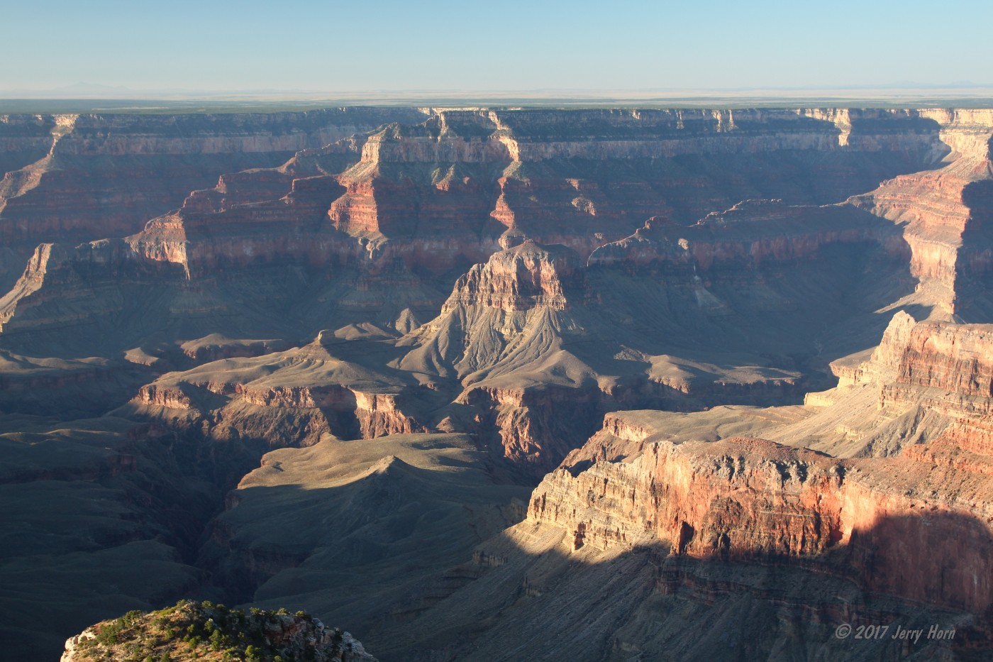
After that ‘not as planned’ visit to Page, AZ, I continued on toward the North Rim of the Grand Canyon. Aside from a strong storm, it was uneventful. Reaching the park, I checked in with the backcountry office. My campsite is 18 miles from the office down a high-clearance dirt road and they had a report of a downed tree blocking the road, so I checked out the visitor center for awhile and took in the views from Bright Angel Point.

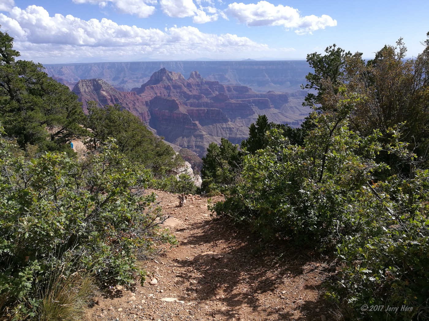
Returning to the office, they told me that the tree was gone so I started out toward Point Sublime. It starts off as a gravel road for access to a hiking trailhead, before switching to dirt. It’s a great drive, alternating through pine forests and open meadows. After 11 miles, there’s a spot where you’ll see the sky through the trees to your left. Take a quick walk and, surprise, you’re on the rim!
A short distance further and the trail has a quick spur that offers a shaded place to park for lunch and walk to the rim. Seven miles later, I reached my campsite on the point. A quarter mile later, the trail ends and the view opens up to an amazing panorama. I turned to the campsite and set up camp, before enjoying an ice-cold can of Coke and a Mountain House meal while watching the sunset. I skimmed through a book I picked up at the visitor center and set an alarm for sunrise.
I wake up at sunrise on Friday the 15th and take a couple photos before going back to bed as I’m in no rush today. I get up a few hours later, lazily eat breakfast and goof off around camp. At 11am, I start packing up as a group of side-by-sides passed by on their way to the picnic area at the end of the trail. After packing up, I drive down to the trail end to take a few more photos.
As I’m getting ready to leave, a group of Jeeps (TJ, LJ and a JKU) roll up, so I hang out for a while longer and chat with the group from California about Jeeps, trailers and trails. We leave together until we split, with them following my entrance route from the visitor center and me following their route from the forest.
After a few miles, I encounter a 20-inch tree across the trail. The side-by-sides and the Jeeps had been able to make a detour around it, but I didn’t want to further tear up the soft ground and widen the trail, so pulled out my chainsaw and went to work. It was too heavy to roll by hand, so I grabbed the winch remote, snatch block and a pair of tree straps to move it off of the trail.

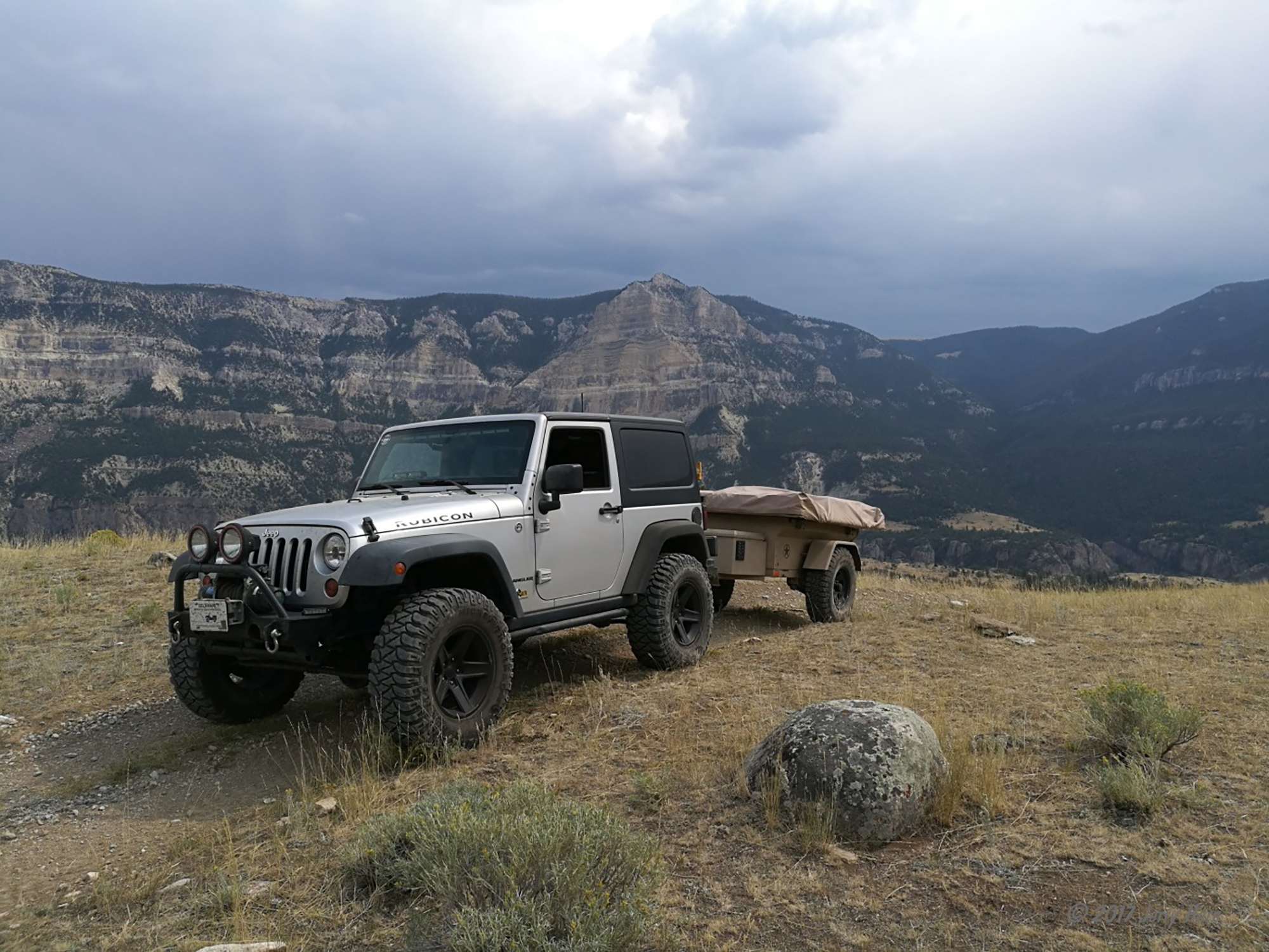
Tree removed, I continued on my way through the forest and returned to pavement north of the forest/park boundary after 47 miles on dirt. I’d originally planned on stopping by Moab for another day or two of trails on my way home, but after the “unplanned” events, I think I need to take it easier. Still, I aim toward Moab as there’s an easy trail along I-70 I can try that’ll take me past some rock art. As I crest a ridgeline west of Jacob Lake, my phone starts beeping - it’s got a full AT&T signal for the first time in several hundred miles! I text out a few photos and continue on towards Moab.
Saturday the 16th finds me pulling onto the highway shoulder after hearing an odd noise. Thankfully, this time it’s a minor problem - a swaybar bolt had loosened and lost the nut and lock washer. After storing the bolt, I left the highway at Crescent Junction, UT. This is known as the rip-off gas station (serious… $2/gal higher than other stations in the area), and exit for US-191 down to Moab. I take a turn onto BLM land and follow the muddy dirt roads through the Book Cliffs and down to the abandoned town of Sego.
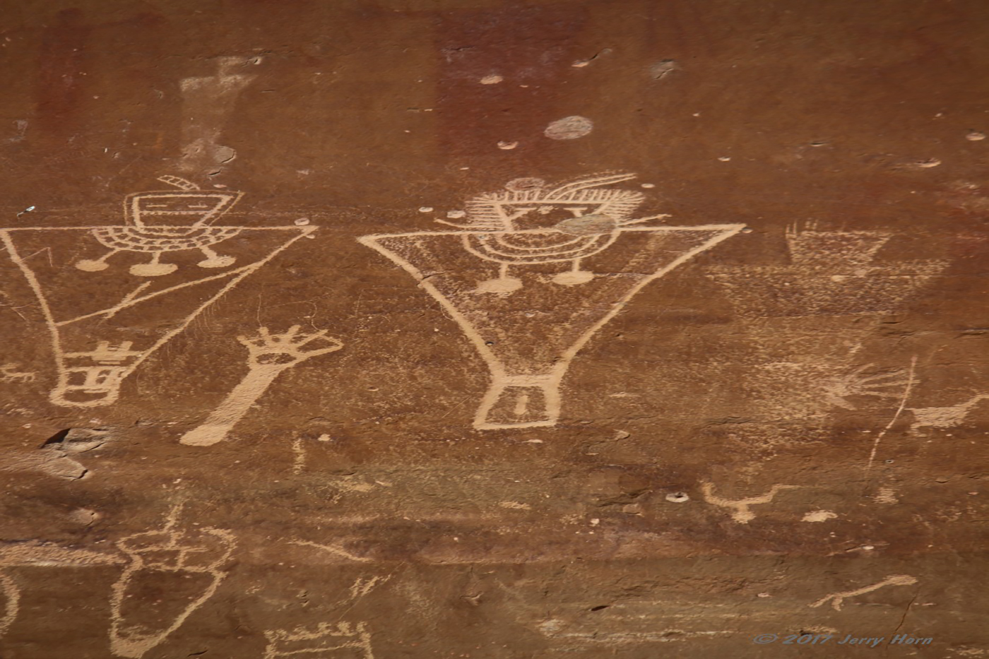
There’s not much recognizable left here, the rusty shell of a 1940s sedan, a collapsed home, the brick walls of an old general store and a few sheds. After leaving Sego, I stop by the rock art. Sadly, this area has a lot more graffiti due to its ease of access, but still a great experience. The canyon walls here are home to several styles of art, indicating that the artists returned here over hundreds or thousands of years. There are many pictographs (paintings), but many petroglyphs (etched designs) are also there if you can spot them.
Moving along, I start east toward Colorado. Shortly before Grand Junction, I exit the highway at Fruita and enter the Colorado National Monument… the main attraction is Rim Rock Drive, a nice 23 mile road through the canyons, offering some spectacular views of the canyons and a unique view of Grand Junction.
After leaving the park, I stop by a hardware store to replace that swaybar bolt and continue down the highway to Rifle. There’s a nice restaurant there I like to stop at called Shooters Grille. After enjoying a nice burger, I continued on and stopped to camp in the mountains outside Vail. It was cold, but I have a Mr Heater ‘Buddy’ propane heater, so I’ll be fine. Well, turns out not so much… my campsite was at 11,145 feet altitude and the thin air triggered the heater’s oxygen safety and wouldn’t let it run more than a few seconds. I didn’t feel like heating up water to do the water bottle method, so instead I threw a few hand warmers onto the bed and went to sleep.
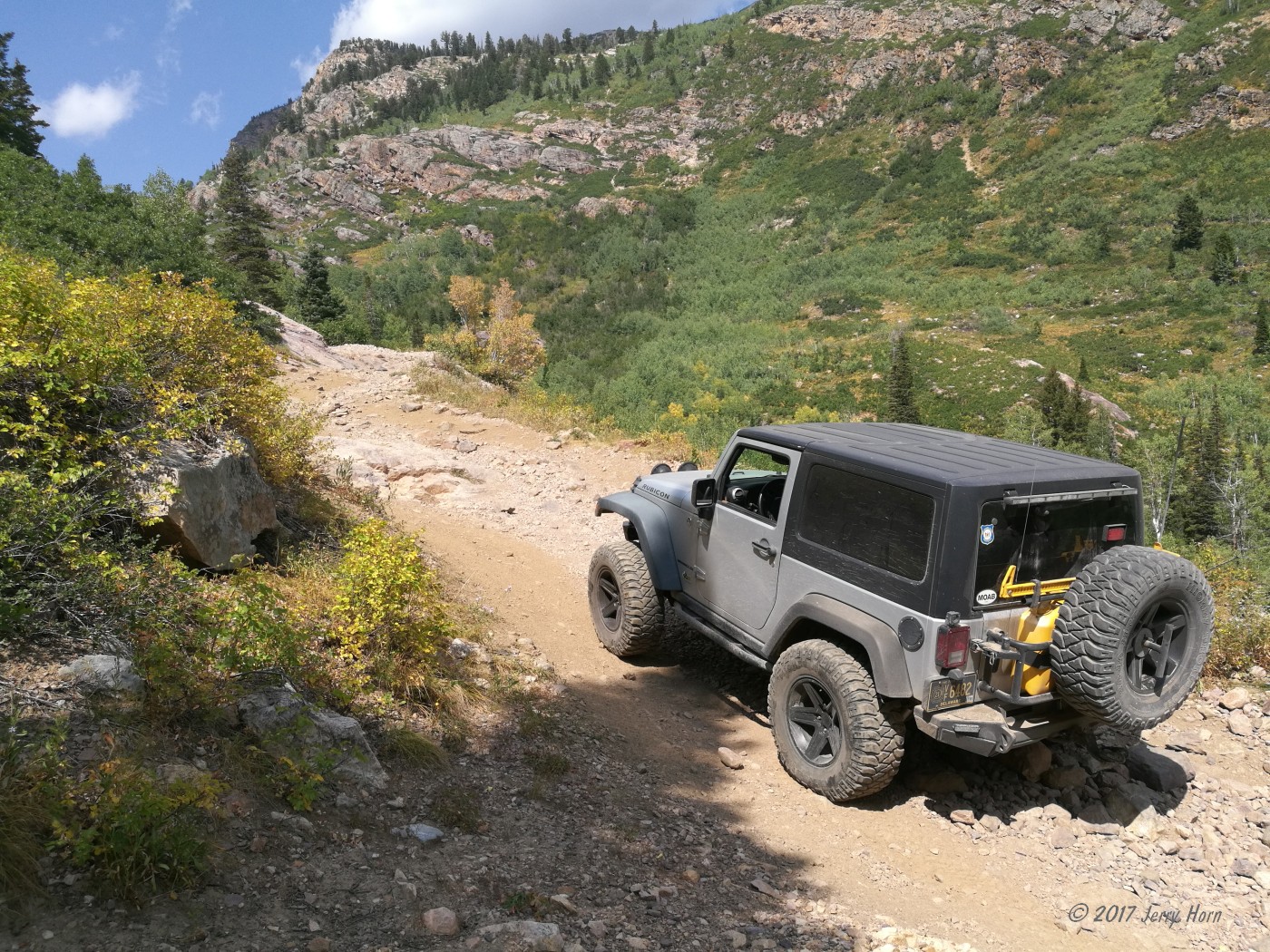
Sunday the 17th I awoke on a chilly mountain before packing up and heading out for my planned route across the mountains. I start off along Shrine Pass Rd, a simple gravel forest track. Near the end of that, a trail takes you along the Wearyman Creek.
This trail wasn’t really talked about on the maps, but was quite rocky as you drive up the stream. It is also a narrow ride with barely enough room for a full-width vehicle. At the only wide part of the trail, I encounter a parked side-by-side. A guy on an ATV I’d passed earlier said it’s been there for several days, supposedly broken. It was stopped at a wide point, but there was a boulder to the side and I engaged both lockers so I wouldn’t slide off the boulder into the Polaris while going around.
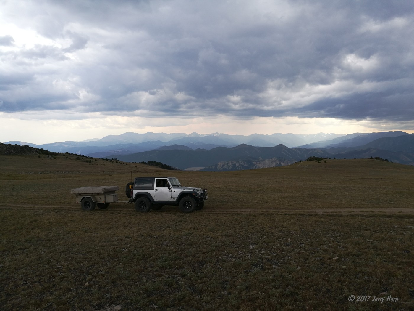
After the mile of creek/trail was done, I was able to start on the McAllister Gulch trail. This is described as a “moderate” trail with a lot of climbing and descents. On my GPS tracker, it started at 9,449’ and hit the max around 11,949’ at the peak of Resolution Mountain. The climb to Resolution Mountain was a steep optional spur, but worth it for the cold, windy views.
The trail ended at the site of Camp Hale - a WWII training facility for the 10th Mountain Division. This unit trained in the harsh mountain terrain here for combat in the European Alps. From there, I head back out to pavement, and eventually highway for an 1800-mile trek back east to Delaware. Fortunately the rest of the trip was uneventful.

Overall, my trip encompassed 8733 miles, with 487 of those on dirt or trail. Several issues with the Jeep and trailer, most due to bolts vibrating loose, although most of those bolts had either Loc-tite or lock washers. But, hey, at least I wasn’t at work!
----------
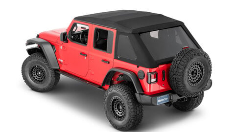
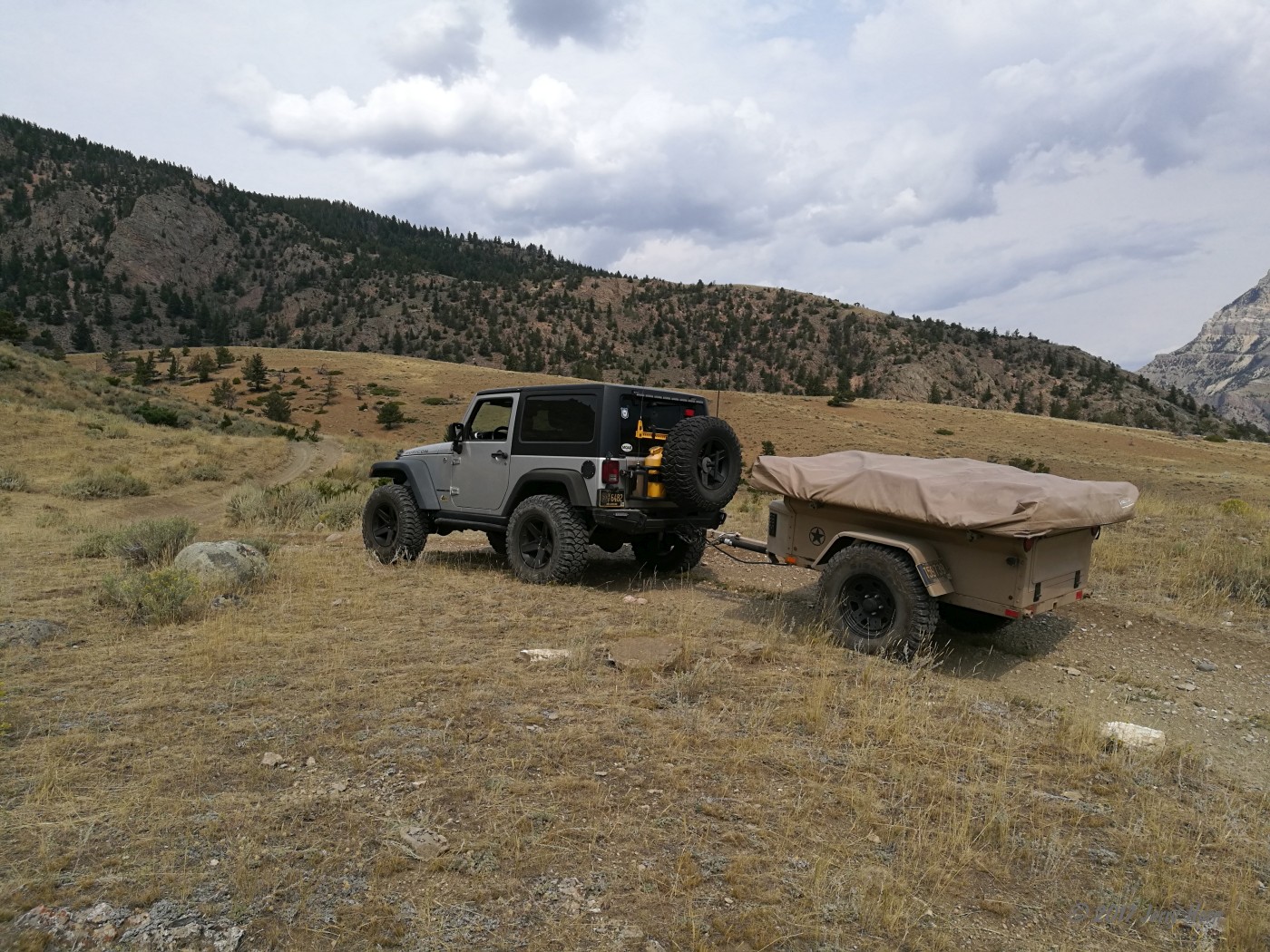
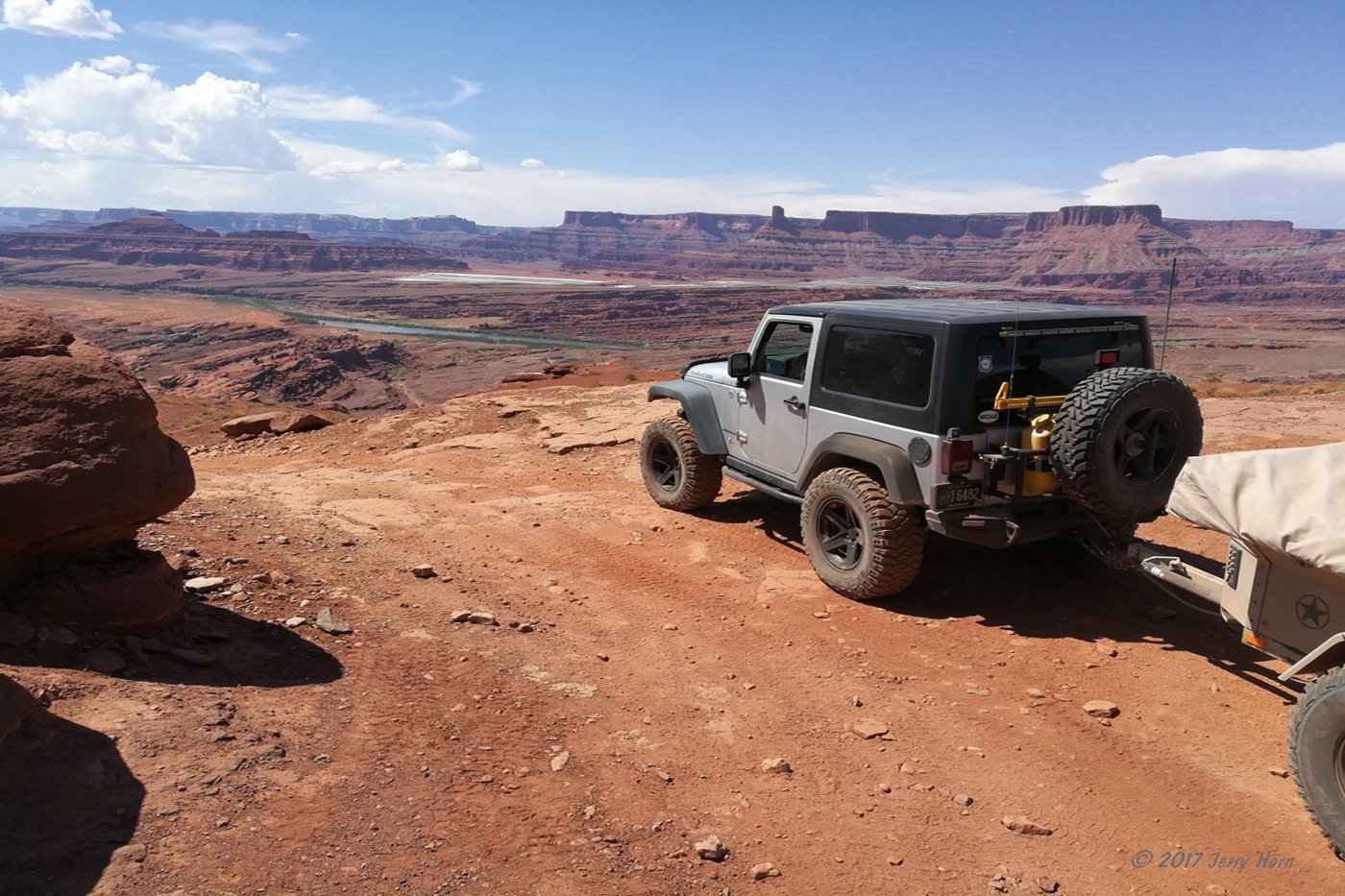
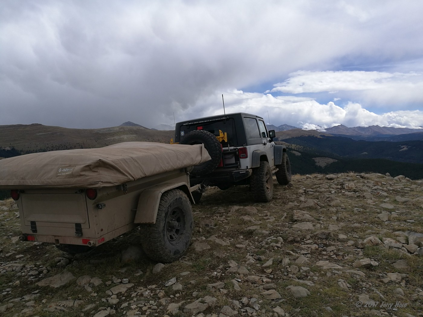
My Jeep is a 2012 Rubicon with a 2.5” lift from AEV; 17” Quadratec Rubicon Xtreme wheels with 35” Mickey Thompson MTZ tires; JCR Offroad Dagger bumper with Superwinch EPi 9.0 winch; Quadratec LED flood lights and Rugged Ridge HID lights; Rugged Ridge Bug Deflector; ACE Engineering side steps; Smittybilt XRC Gen 2 rear bumper with custom-mount 7-pin trailer harness; OR-Fab tire carrier with two 5-gallon fuel cans; Hi-lift jack and antennas. Under the Jeep is a JCR engine skid plate and a Viair 450C air compressor feeding a Warn 2.5 gal air tank. Inside I have Quadratec floor liners, a Tuffy security console insert, Cobra CB radio, Kenwood TM-D710 ham radio and various other goodies including a fridge so I don’t have to worry about melting ice. An Optima Red Top battery supplies juice for the winch and fridge. I used Staun tire deflators to make airing down easier.
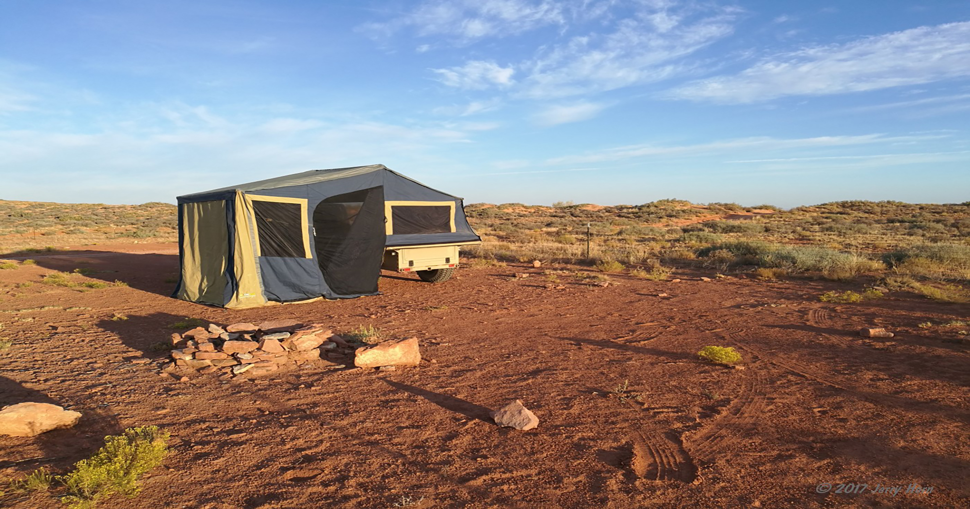
My trailer is a home-built design with a fiberglass body kit from Dinoot, using a CJ-7 tailgate. The trailer sits on 16” Black Rock Lobo wheels and 33” Maxxis Bighorn tires. Atop the trailer is an OzTrail Outer Ridge Venturer tent. It uses a Max-Coupler hitch for 3-axis articulation and a Timbren Axle-less suspension for incredible ground clearance.
I also carry various recovery gear items: three stainless shackles, two standard shackles, two tree straps, 20’ and 30’ recovery straps, a 14’ tow chain, a Superwinch snatch block, multiple hitch pins, an E-tool/shovel, a 48” Hi-Lift jack, a Hi-Lift jack base and a few other things. A good selection of tools (including an air impact gun) was in the trailer and moved to the Jeep when running separate from the trailer. A tote with emergency fluids (oil, brake fluid, trans fluid, coolant) was in the trailer as well.